You are here: Home > Network List > BK - Berkeley Digital Seismograph Network Stations List
> Station HUMO Hull Mountain, OR > Earthquake Result Viewer
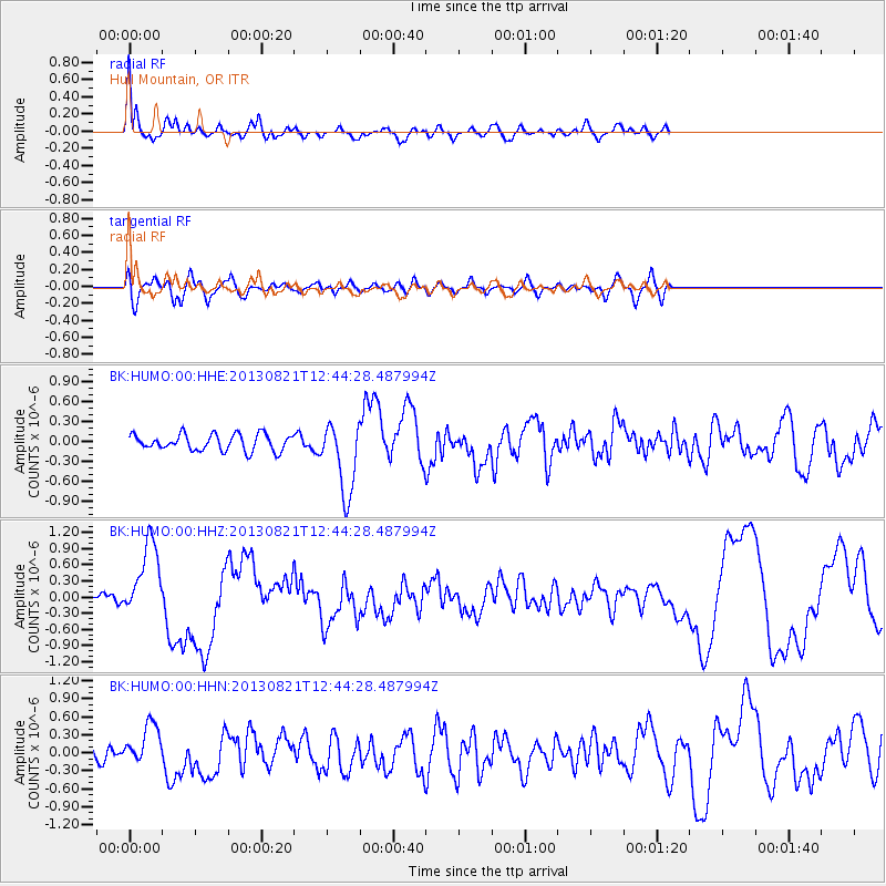
HUMO Hull Mountain, OR - Earthquake Result Viewer
*The percent match for this event was below the threshold and hence no stack was calculated.
| Earthquake location: |
Near Coast Of Guerrero, Mexico |
| Earthquake latitude/longitude: |
16.9/-99.5 |
| Earthquake time(UTC): |
2013/08/21 (233) 12:38:29 GMT |
| Earthquake Depth: |
21 km |
| Earthquake Magnitude: |
6.2 MWW, 6.2 MWW, 6.2 MWB, 6.2 MWC |
| Earthquake Catalog/Contributor: |
NEIC PDE/NEIC COMCAT |
|
| Network: |
BK Berkeley Digital Seismograph Network |
| Station: |
HUMO Hull Mountain, OR |
| Lat/Lon: |
42.61 N/122.96 W |
| Elevation: |
555 m |
|
| Distance: |
32.5 deg |
| Az: |
326.873 deg |
| Baz: |
134.867 deg |
| Ray Param: |
$rayparam |
*The percent match for this event was below the threshold and hence was not used in the summary stack. |
|
| Radial Match: |
71.26133 % |
| Radial Bump: |
400 |
| Transverse Match: |
65.69777 % |
| Transverse Bump: |
400 |
| SOD ConfigId: |
626651 |
| Insert Time: |
2014-04-18 01:50:30.587 +0000 |
| GWidth: |
2.5 |
| Max Bumps: |
400 |
| Tol: |
0.001 |
|
Signal To Noise
| Channel | StoN | STA | LTA |
| BK:HUMO:00:HHZ:20130821T12:44:28.487994Z | 4.642301 | 6.9072007E-7 | 1.487883E-7 |
| BK:HUMO:00:HHN:20130821T12:44:28.487994Z | 1.9746776 | 3.3583203E-7 | 1.7006928E-7 |
| BK:HUMO:00:HHE:20130821T12:44:28.487994Z | 4.430701 | 5.486555E-7 | 1.2383042E-7 |
| Arrivals |
| Ps | |
| PpPs | |
| PsPs/PpSs | |


