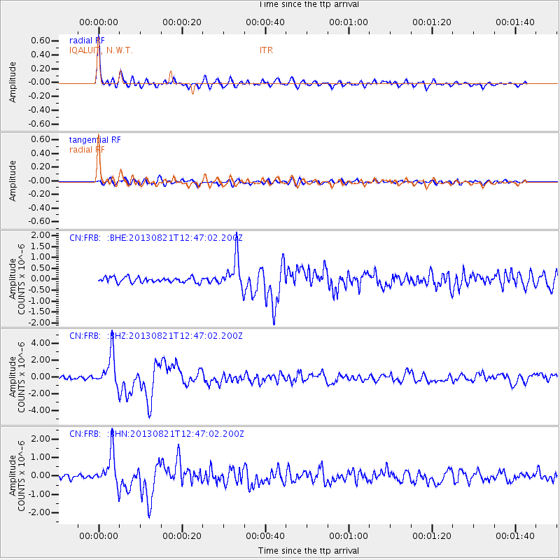
FRB IQALUIT, N.W.T. - Earthquake Result Viewer
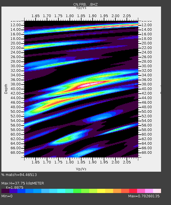
Earthquake location: Near Coast Of Guerrero, Mexico
Earthquake latitude/longitude: 16.9/-99.5
Earthquake time(UTC): 2013/08/21 (233) 12:38:29 GMT
Earthquake Depth: 21 km
Earthquake Magnitude: 6.2 MWW, 6.2 MWW, 6.2 MWB, 6.2 MWC
Earthquake Catalog/Contributor: NEIC PDE/NEIC COMCAT
Network: CN Canadian National Seismograph Network
Station: FRB IQALUIT, N.W.T.
Lat/Lon: 63.75 N/68.55 W
Elevation: 18 m
Distance: 51.4 deg
Az: 17.014 deg
Baz: 219.045 deg
Ray Param: 0.06740044
Estimated Moho Depth: 37.75 km
Estimated Crust Vp/Vs: 1.89
Assumed Crust Vp: 6.419 km/s
Estimated Crust Vs: 3.401 km/s
Estimated Crust Poisson's Ratio: 0.30
Radial Match: 94.46513 %
Radial Bump: 400
Transverse Match: 71.51551 %
Transverse Bump: 400
SOD ConfigId: 626651
Insert Time: 2014-04-18 01:52:33.094 +0000
GWidth: 2.5
Max Bumps: 400
Tol: 0.001

Signal To Noise

ChannelStoNSTALTA
CN:FRB: :BHZ:20130821T12:47:02.200Z14.9124092.0461205E-61.3720926E-7
CN:FRB: :BHN:20130821T12:47:02.200Z7.3992999.381859E-71.2679389E-7
CN:FRB: :BHE:20130821T12:47:02.200Z6.4050387.3507044E-71.1476442E-7
Arrivals
Ps5.5 SECOND
PpPs16 SECOND
PsPs/PpSs22 SECOND