
LLLB LILLOOET, BC, CANADA ADA - Earthquake Result Viewer
| ||||||||||||||||||
| ||||||||||||||||||
| ||||||||||||||||||
|
Signal To Noise
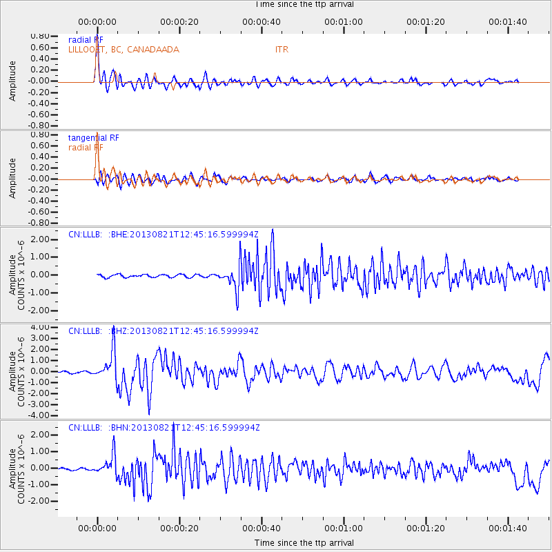
| Channel | StoN | STA | LTA |
| CN:LLLB: :BHZ:20130821T12:45:16.599994Z | 15.15662 | 1.3710372E-6 | 9.0457974E-8 |
| CN:LLLB: :BHN:20130821T12:45:16.599994Z | 5.467196 | 6.400051E-7 | 1.17062775E-7 |
| CN:LLLB: :BHE:20130821T12:45:16.599994Z | 8.454055 | 6.8873027E-7 | 8.146744E-8 |
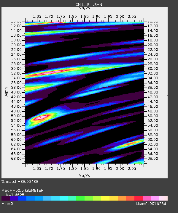
| Arrivals | |
| Ps | 5.5 SECOND |
| PpPs | 19 SECOND |
| PsPs/PpSs | 24 SECOND |

