
ULM LAC DU BONNET, MB - Earthquake Result Viewer
| ||||||||||||||||||
| ||||||||||||||||||
| ||||||||||||||||||
|
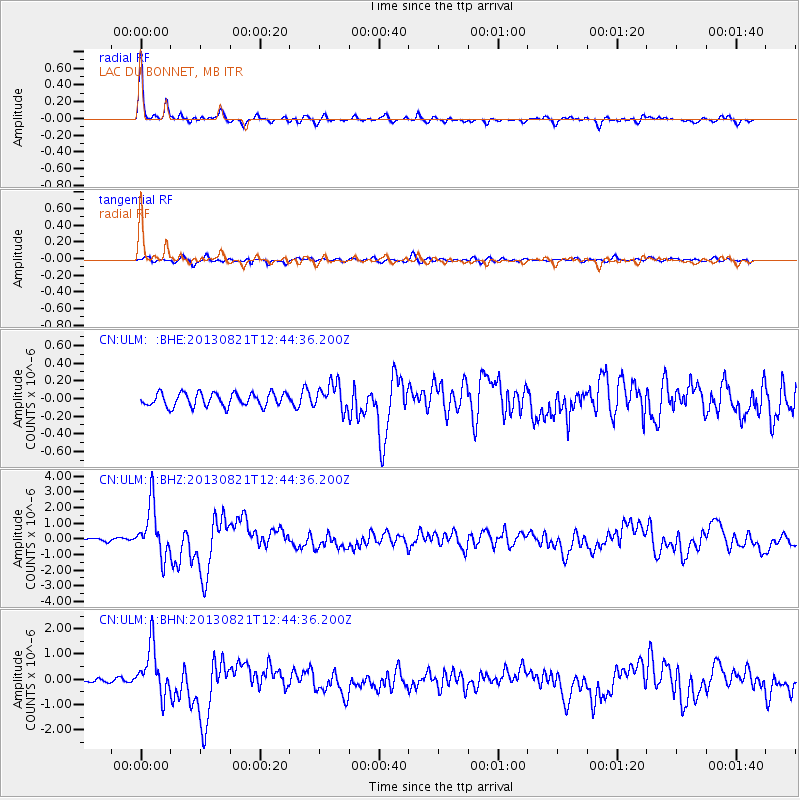
Signal To Noise
| Channel | StoN | STA | LTA |
| CN:ULM: :BHZ:20130821T12:44:36.200Z | 16.52486 | 1.6366428E-6 | 9.904125E-8 |
| CN:ULM: :BHN:20130821T12:44:36.200Z | 13.629685 | 9.785748E-7 | 7.179732E-8 |
| CN:ULM: :BHE:20130821T12:44:36.200Z | 1.9791832 | 1.4864742E-7 | 7.510544E-8 |
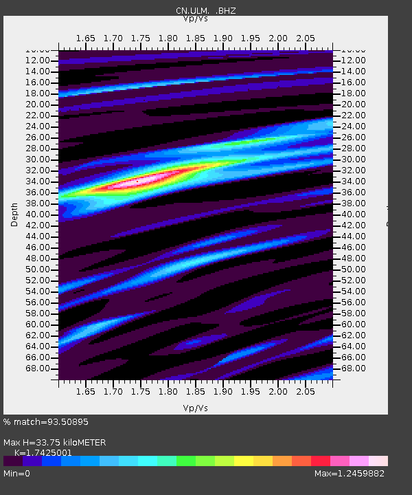
| Arrivals | |
| Ps | 4.2 SECOND |
| PpPs | 13 SECOND |
| PsPs/PpSs | 17 SECOND |

