You are here: Home > Network List > IU - Global Seismograph Network (GSN - IRIS/USGS) Stations List
> Station JOHN Johnston Island, USA > Earthquake Result Viewer
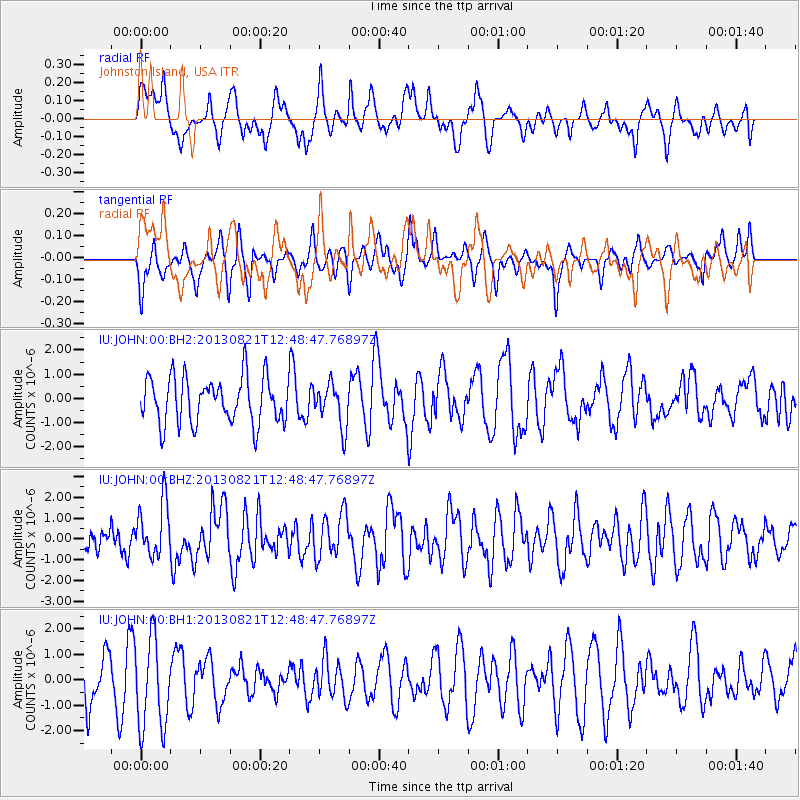
JOHN Johnston Island, USA - Earthquake Result Viewer
*The percent match for this event was below the threshold and hence no stack was calculated.
| Earthquake location: |
Near Coast Of Guerrero, Mexico |
| Earthquake latitude/longitude: |
16.9/-99.5 |
| Earthquake time(UTC): |
2013/08/21 (233) 12:38:29 GMT |
| Earthquake Depth: |
21 km |
| Earthquake Magnitude: |
6.2 MWW, 6.2 MWW, 6.2 MWB, 6.2 MWC |
| Earthquake Catalog/Contributor: |
NEIC PDE/NEIC COMCAT |
|
| Network: |
IU Global Seismograph Network (GSN - IRIS/USGS) |
| Station: |
JOHN Johnston Island, USA |
| Lat/Lon: |
16.73 N/169.53 W |
| Elevation: |
2.0 m |
|
| Distance: |
66.7 deg |
| Az: |
281.275 deg |
| Baz: |
78.509 deg |
| Ray Param: |
$rayparam |
*The percent match for this event was below the threshold and hence was not used in the summary stack. |
|
| Radial Match: |
56.002895 % |
| Radial Bump: |
400 |
| Transverse Match: |
45.08977 % |
| Transverse Bump: |
339 |
| SOD ConfigId: |
626651 |
| Insert Time: |
2014-04-18 01:58:05.921 +0000 |
| GWidth: |
2.5 |
| Max Bumps: |
400 |
| Tol: |
0.001 |
|
Signal To Noise
| Channel | StoN | STA | LTA |
| IU:JOHN:00:BHZ:20130821T12:48:47.76897Z | 1.9832478 | 1.3125225E-6 | 6.6180456E-7 |
| IU:JOHN:00:BH1:20130821T12:48:47.76897Z | 2.2979276 | 1.7870597E-6 | 7.7768317E-7 |
| IU:JOHN:00:BH2:20130821T12:48:47.76897Z | 0.91696644 | 8.770692E-7 | 9.5649E-7 |
| Arrivals |
| Ps | |
| PpPs | |
| PsPs/PpSs | |


