
WRPS We R Penn State - Earthquake Result Viewer
| ||||||||||||||||||
| ||||||||||||||||||
| ||||||||||||||||||
|
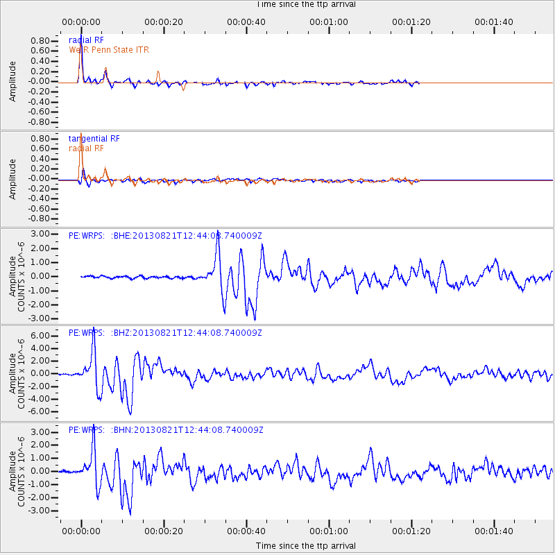
Signal To Noise
| Channel | StoN | STA | LTA |
| PE:WRPS: :BHZ:20130821T12:44:08.740009Z | 37.03655 | 2.9237083E-6 | 7.894116E-8 |
| PE:WRPS: :BHN:20130821T12:44:08.740009Z | 14.25002 | 1.349848E-6 | 9.472604E-8 |
| PE:WRPS: :BHE:20130821T12:44:08.740009Z | 19.948149 | 1.3731602E-6 | 6.883648E-8 |
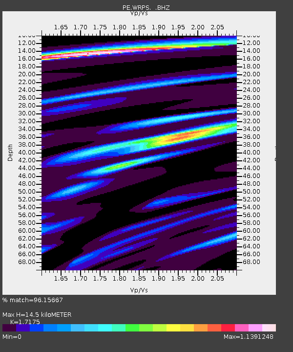
| Arrivals | |
| Ps | 1.8 SECOND |
| PpPs | 6.0 SECOND |
| PsPs/PpSs | 7.8 SECOND |

