D41A Chassel, MI, USA - Earthquake Result Viewer
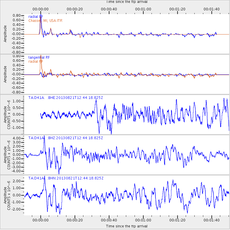
Earthquake location: Near Coast Of Guerrero, Mexico
Earthquake latitude/longitude: 16.9/-99.5
Earthquake time(UTC): 2013/08/21 (233) 12:38:29 GMT
Earthquake Depth: 21 km
Earthquake Magnitude: 6.2 MWW, 6.2 MWW, 6.2 MWB, 6.2 MWC
Earthquake Catalog/Contributor: NEIC PDE/NEIC COMCAT
Network: TA USArray Transportable Network (new EarthScope stations)
Station: D41A Chassel, MI, USA
Lat/Lon: 47.06 N/88.57 W
Elevation: 271 m
Distance: 31.4 deg
Az: 14.398 deg
Baz: 200.38 deg
Ray Param: 0.079058416
Estimated Moho Depth: 34.5 km
Estimated Crust Vp/Vs: 2.04
Assumed Crust Vp: 6.467 km/s
Estimated Crust Vs: 3.17 km/s
Estimated Crust Poisson's Ratio: 0.34
Radial Match: 90.76638 %
Radial Bump: 275
Transverse Match: 70.20653 %
Transverse Bump: 400
SOD ConfigId: 626651
Insert Time: 2014-04-18 02:06:01.632 +0000
GWidth: 2.5
Max Bumps: 400
Tol: 0.001

Signal To Noise

ChannelStoNSTALTA
TA:D41A: :BHZ:20130821T12:44:18.825Z10.0970981.8774903E-61.8594356E-7
TA:D41A: :BHN:20130821T12:44:18.825Z5.99856851.211319E-62.019347E-7
TA:D41A: :BHE:20130821T12:44:18.825Z4.5893556.3611344E-71.386063E-7
Arrivals
Ps6.0 SECOND
PpPs15 SECOND
PsPs/PpSs21 SECOND