
D52A ZEK Kipawa Senerzegues Township, QC, CAN - Earthquake Result Viewer
| ||||||||||||||||||
| ||||||||||||||||||
| ||||||||||||||||||
|
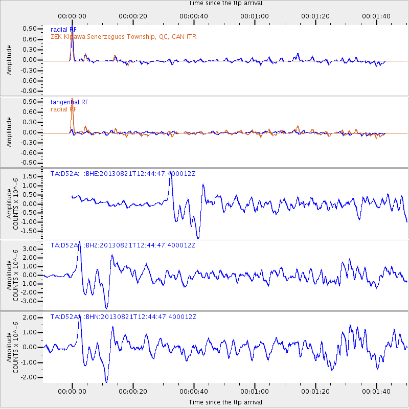
Signal To Noise
| Channel | StoN | STA | LTA |
| TA:D52A: :BHZ:20130821T12:44:47.400012Z | 15.199011 | 1.8016059E-6 | 1.18534416E-7 |
| TA:D52A: :BHN:20130821T12:44:47.400012Z | 8.494238 | 9.717784E-7 | 1.1440443E-7 |
| TA:D52A: :BHE:20130821T12:44:47.400012Z | 4.7471833 | 7.735708E-7 | 1.6295363E-7 |
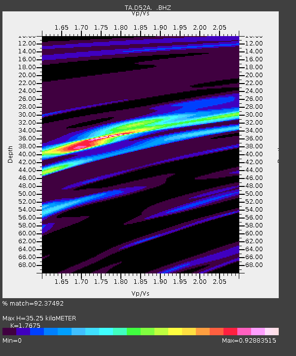
| Arrivals | |
| Ps | 4.4 SECOND |
| PpPs | 14 SECOND |
| PsPs/PpSs | 18 SECOND |

