
D55A Sainte-Anne-du-Lac, QC, CAN - Earthquake Result Viewer
| ||||||||||||||||||
| ||||||||||||||||||
| ||||||||||||||||||
|
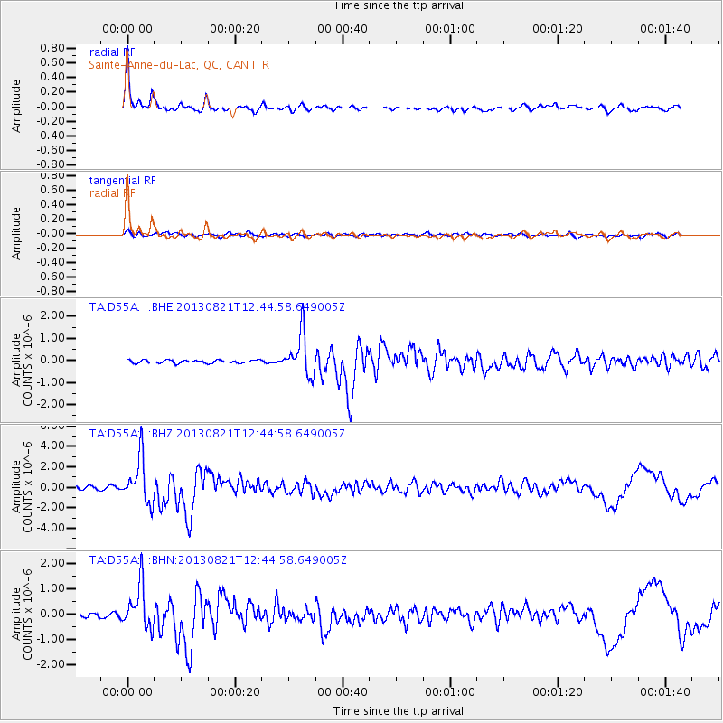
Signal To Noise
| Channel | StoN | STA | LTA |
| TA:D55A: :BHZ:20130821T12:44:58.649005Z | 14.280852 | 2.2041834E-6 | 1.5434537E-7 |
| TA:D55A: :BHN:20130821T12:44:58.649005Z | 8.007833 | 8.7061204E-7 | 1.08720066E-7 |
| TA:D55A: :BHE:20130821T12:44:58.649005Z | 14.066234 | 9.58725E-7 | 6.81579E-8 |
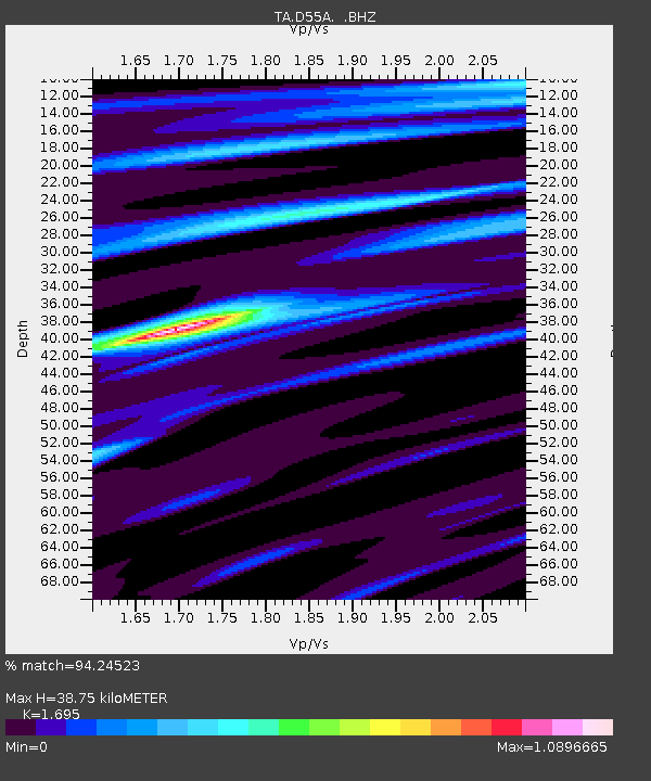
| Arrivals | |
| Ps | 4.4 SECOND |
| PpPs | 15 SECOND |
| PsPs/PpSs | 19 SECOND |

