E04D Cinebar, WA, USA - Earthquake Result Viewer
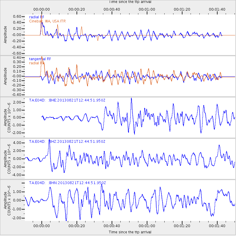
Earthquake location: Near Coast Of Guerrero, Mexico
Earthquake latitude/longitude: 16.9/-99.5
Earthquake time(UTC): 2013/08/21 (233) 12:38:29 GMT
Earthquake Depth: 21 km
Earthquake Magnitude: 6.2 MWW, 6.2 MWW, 6.2 MWB, 6.2 MWC
Earthquake Catalog/Contributor: NEIC PDE/NEIC COMCAT
Network: TA USArray Transportable Network (new EarthScope stations)
Station: E04D Cinebar, WA, USA
Lat/Lon: 46.56 N/122.57 W
Elevation: 204 m
Distance: 35.2 deg
Az: 332.056 deg
Baz: 139.445 deg
Ray Param: 0.07729981
Estimated Moho Depth: 14.5 km
Estimated Crust Vp/Vs: 1.60
Assumed Crust Vp: 6.566 km/s
Estimated Crust Vs: 4.097 km/s
Estimated Crust Poisson's Ratio: 0.18
Radial Match: 82.89491 %
Radial Bump: 400
Transverse Match: 53.71407 %
Transverse Bump: 400
SOD ConfigId: 626651
Insert Time: 2014-04-18 02:06:49.603 +0000
GWidth: 2.5
Max Bumps: 400
Tol: 0.001

Signal To Noise

ChannelStoNSTALTA
TA:E04D: :BHZ:20130821T12:44:51.950Z7.55026771.7967835E-62.3797612E-7
TA:E04D: :BHN:20130821T12:44:51.950Z2.30693915.430846E-72.354135E-7
TA:E04D: :BHE:20130821T12:44:51.950Z3.65480526.7295537E-71.8412894E-7
Arrivals
Ps1.5 SECOND
PpPs5.3 SECOND
PsPs/PpSs6.7 SECOND