E46A Sault Ste Marie, MI, USA - Earthquake Result Viewer
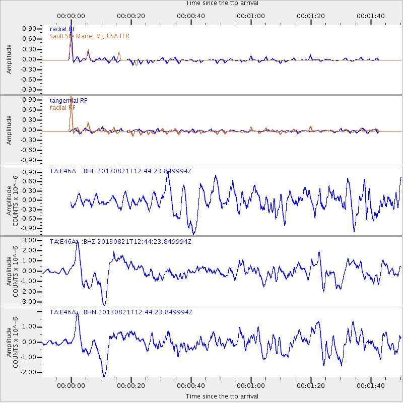
Earthquake location: Near Coast Of Guerrero, Mexico
Earthquake latitude/longitude: 16.9/-99.5
Earthquake time(UTC): 2013/08/21 (233) 12:38:29 GMT
Earthquake Depth: 21 km
Earthquake Magnitude: 6.2 MWW, 6.2 MWW, 6.2 MWB, 6.2 MWC
Earthquake Catalog/Contributor: NEIC PDE/NEIC COMCAT
Network: TA USArray Transportable Network (new EarthScope stations)
Station: E46A Sault Ste Marie, MI, USA
Lat/Lon: 46.37 N/84.31 W
Elevation: 269 m
Distance: 32.0 deg
Az: 20.024 deg
Baz: 208.258 deg
Ray Param: 0.07881478
Estimated Moho Depth: 13.75 km
Estimated Crust Vp/Vs: 1.94
Assumed Crust Vp: 6.467 km/s
Estimated Crust Vs: 3.338 km/s
Estimated Crust Poisson's Ratio: 0.32
Radial Match: 92.061386 %
Radial Bump: 262
Transverse Match: 70.24412 %
Transverse Bump: 400
SOD ConfigId: 626651
Insert Time: 2014-04-18 02:06:59.169 +0000
GWidth: 2.5
Max Bumps: 400
Tol: 0.001

Signal To Noise

ChannelStoNSTALTA
TA:E46A: :BHZ:20130821T12:44:23.849994Z10.4173491.4130725E-61.3564606E-7
TA:E46A: :BHN:20130821T12:44:23.849994Z9.4214988.453486E-78.9725496E-8
TA:E46A: :BHE:20130821T12:44:23.849994Z3.55481744.4769808E-71.2594123E-7
Arrivals
Ps2.1 SECOND
PpPs5.8 SECOND
PsPs/PpSs7.9 SECOND