
E48A Lockeyer, ON, CAN - Earthquake Result Viewer
| ||||||||||||||||||
| ||||||||||||||||||
| ||||||||||||||||||
|
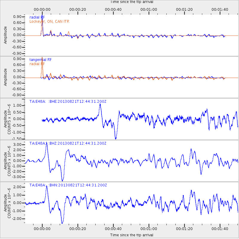
Signal To Noise
| Channel | StoN | STA | LTA |
| TA:E48A: :BHZ:20130821T12:44:31.200Z | 11.740141 | 1.5836479E-6 | 1.3489174E-7 |
| TA:E48A: :BHN:20130821T12:44:31.200Z | 12.420495 | 9.82142E-7 | 7.9074304E-8 |
| TA:E48A: :BHE:20130821T12:44:31.200Z | 6.241038 | 5.186661E-7 | 8.3105746E-8 |
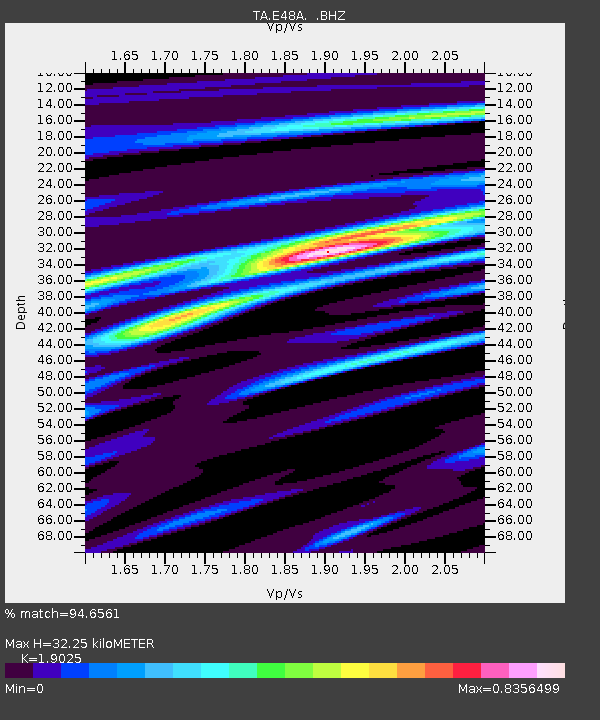
| Arrivals | |
| Ps | 4.8 SECOND |
| PpPs | 13 SECOND |
| PsPs/PpSs | 18 SECOND |

