E56A St. Veronique, QC, CAN - Earthquake Result Viewer
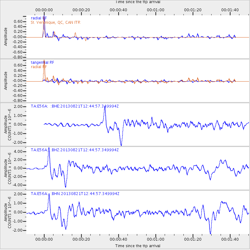
Earthquake location: Near Coast Of Guerrero, Mexico
Earthquake latitude/longitude: 16.9/-99.5
Earthquake time(UTC): 2013/08/21 (233) 12:38:29 GMT
Earthquake Depth: 21 km
Earthquake Magnitude: 6.2 MWW, 6.2 MWW, 6.2 MWB, 6.2 MWC
Earthquake Catalog/Contributor: NEIC PDE/NEIC COMCAT
Network: TA USArray Transportable Network (new EarthScope stations)
Station: E56A St. Veronique, QC, CAN
Lat/Lon: 46.54 N/75.03 W
Elevation: 320 m
Distance: 35.9 deg
Az: 29.197 deg
Baz: 222.584 deg
Ray Param: 0.07696211
Estimated Moho Depth: 17.5 km
Estimated Crust Vp/Vs: 1.60
Assumed Crust Vp: 6.61 km/s
Estimated Crust Vs: 4.125 km/s
Estimated Crust Poisson's Ratio: 0.18
Radial Match: 92.74612 %
Radial Bump: 214
Transverse Match: 79.7564 %
Transverse Bump: 400
SOD ConfigId: 626651
Insert Time: 2014-04-18 02:07:19.263 +0000
GWidth: 2.5
Max Bumps: 400
Tol: 0.001

Signal To Noise

ChannelStoNSTALTA
TA:E56A: :BHZ:20130821T12:44:57.349994Z14.1196952.0109799E-61.4242376E-7
TA:E56A: :BHN:20130821T12:44:57.349994Z4.55787137.424651E-71.6289734E-7
TA:E56A: :BHE:20130821T12:44:57.349994Z7.73802478.00726E-71.0347939E-7
Arrivals
Ps1.7 SECOND
PpPs6.3 SECOND
PsPs/PpSs8.0 SECOND