E59A St. Maurice, QC, CAN - Earthquake Result Viewer
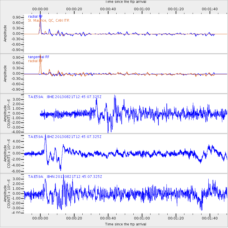
Earthquake location: Near Coast Of Guerrero, Mexico
Earthquake latitude/longitude: 16.9/-99.5
Earthquake time(UTC): 2013/08/21 (233) 12:38:29 GMT
Earthquake Depth: 21 km
Earthquake Magnitude: 6.2 MWW, 6.2 MWW, 6.2 MWB, 6.2 MWC
Earthquake Catalog/Contributor: NEIC PDE/NEIC COMCAT
Network: TA USArray Transportable Network (new EarthScope stations)
Station: E59A St. Maurice, QC, CAN
Lat/Lon: 46.48 N/72.51 W
Elevation: 62 m
Distance: 37.0 deg
Az: 31.368 deg
Baz: 226.155 deg
Ray Param: 0.07632313
Estimated Moho Depth: 28.0 km
Estimated Crust Vp/Vs: 1.76
Assumed Crust Vp: 6.61 km/s
Estimated Crust Vs: 3.756 km/s
Estimated Crust Poisson's Ratio: 0.26
Radial Match: 94.53548 %
Radial Bump: 235
Transverse Match: 75.17297 %
Transverse Bump: 400
SOD ConfigId: 626651
Insert Time: 2014-04-18 02:07:31.313 +0000
GWidth: 2.5
Max Bumps: 400
Tol: 0.001

Signal To Noise

ChannelStoNSTALTA
TA:E59A: :BHZ:20130821T12:45:07.325Z8.203432.387008E-62.909768E-7
TA:E59A: :BHN:20130821T12:45:07.325Z2.90573861.2753546E-64.3890893E-7
TA:E59A: :BHE:20130821T12:45:07.325Z3.267481.2931556E-63.9576543E-7
Arrivals
Ps3.5 SECOND
PpPs11 SECOND
PsPs/PpSs14 SECOND