F48A Evansville, ON, CAN - Earthquake Result Viewer
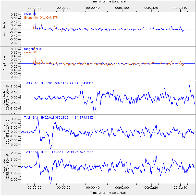
Earthquake location: Near Coast Of Guerrero, Mexico
Earthquake latitude/longitude: 16.9/-99.5
Earthquake time(UTC): 2013/08/21 (233) 12:38:29 GMT
Earthquake Depth: 21 km
Earthquake Magnitude: 6.2 MWW, 6.2 MWW, 6.2 MWB, 6.2 MWC
Earthquake Catalog/Contributor: NEIC PDE/NEIC COMCAT
Network: TA USArray Transportable Network (new EarthScope stations)
Station: F48A Evansville, ON, CAN
Lat/Lon: 45.83 N/82.62 W
Elevation: 203 m
Distance: 32.1 deg
Az: 22.448 deg
Baz: 211.524 deg
Ray Param: 0.07876454
Estimated Moho Depth: 51.0 km
Estimated Crust Vp/Vs: 1.60
Assumed Crust Vp: 6.483 km/s
Estimated Crust Vs: 4.052 km/s
Estimated Crust Poisson's Ratio: 0.18
Radial Match: 93.71935 %
Radial Bump: 306
Transverse Match: 67.27048 %
Transverse Bump: 400
SOD ConfigId: 626651
Insert Time: 2014-04-18 02:07:52.791 +0000
GWidth: 2.5
Max Bumps: 400
Tol: 0.001

Signal To Noise

ChannelStoNSTALTA
TA:F48A: :BHZ:20130821T12:44:24.874988Z9.1775641.6143412E-61.7590085E-7
TA:F48A: :BHN:20130821T12:44:24.874988Z8.8701491.033184E-61.1647878E-7
TA:F48A: :BHE:20130821T12:44:24.874988Z5.4072374.9522157E-79.158495E-8
Arrivals
Ps5.2 SECOND
PpPs19 SECOND
PsPs/PpSs24 SECOND