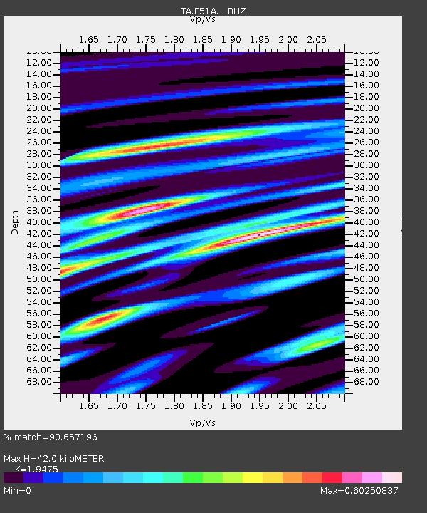
F51A Arnstein, ON, CAN - Earthquake Result Viewer

Earthquake location: Near Coast Of Guerrero, Mexico
Earthquake latitude/longitude: 16.9/-99.5
Earthquake time(UTC): 2013/08/21 (233) 12:38:29 GMT
Earthquake Depth: 21 km
Earthquake Magnitude: 6.2 MWW, 6.2 MWW, 6.2 MWB, 6.2 MWC
Earthquake Catalog/Contributor: NEIC PDE/NEIC COMCAT
Network: TA USArray Transportable Network (new EarthScope stations)
Station: F51A Arnstein, ON, CAN
Lat/Lon: 45.93 N/79.92 W
Elevation: 239 m
Distance: 33.3 deg
Az: 25.255 deg
Baz: 215.822 deg
Ray Param: 0.078269504
Estimated Moho Depth: 42.0 km
Estimated Crust Vp/Vs: 1.95
Assumed Crust Vp: 6.577 km/s
Estimated Crust Vs: 3.377 km/s
Estimated Crust Poisson's Ratio: 0.32
Radial Match: 90.657196 %
Radial Bump: 259
Transverse Match: 69.64985 %
Transverse Bump: 400
SOD ConfigId: 626651
Insert Time: 2014-04-18 02:08:00.961 +0000
GWidth: 2.5
Max Bumps: 400
Tol: 0.001

Signal To Noise

ChannelStoNSTALTA
TA:F51A: :BHZ:20130821T12:44:34.749988Z7.42163941.465921E-61.9751984E-7
TA:F51A: :BHN:20130821T12:44:34.749988Z5.4217947.336829E-71.3532107E-7
TA:F51A: :BHE:20130821T12:44:34.749988Z5.11802676.161925E-71.203965E-7
Arrivals
Ps6.5 SECOND
PpPs17 SECOND
PsPs/PpSs24 SECOND