
F61A St Evariste, QC, CAN - Earthquake Result Viewer
| ||||||||||||||||||
| ||||||||||||||||||
| ||||||||||||||||||
|
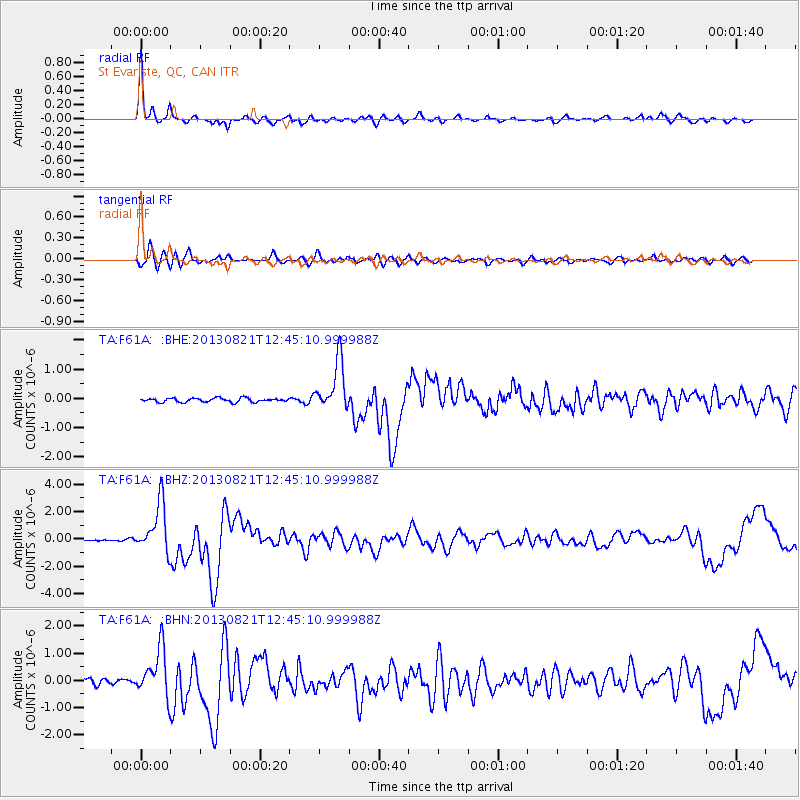
Signal To Noise
| Channel | StoN | STA | LTA |
| TA:F61A: :BHZ:20130821T12:45:10.999988Z | 14.347938 | 1.8149833E-6 | 1.2649785E-7 |
| TA:F61A: :BHN:20130821T12:45:10.999988Z | 8.255857 | 8.750766E-7 | 1.0599464E-7 |
| TA:F61A: :BHE:20130821T12:45:10.999988Z | 12.641064 | 8.446732E-7 | 6.681979E-8 |
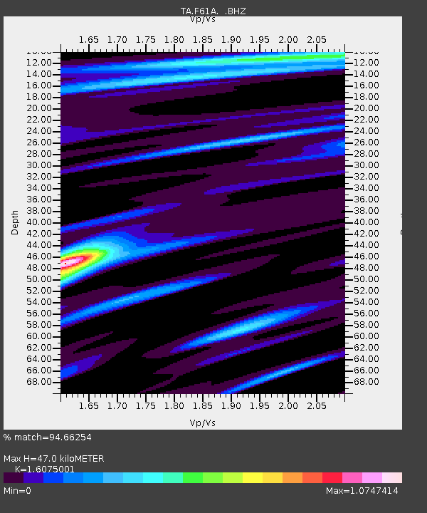
| Arrivals | |
| Ps | 4.8 SECOND |
| PpPs | 18 SECOND |
| PsPs/PpSs | 22 SECOND |

