
G53A Haliburton, ON, CAN - Earthquake Result Viewer
| ||||||||||||||||||
| ||||||||||||||||||
| ||||||||||||||||||
|

Signal To Noise
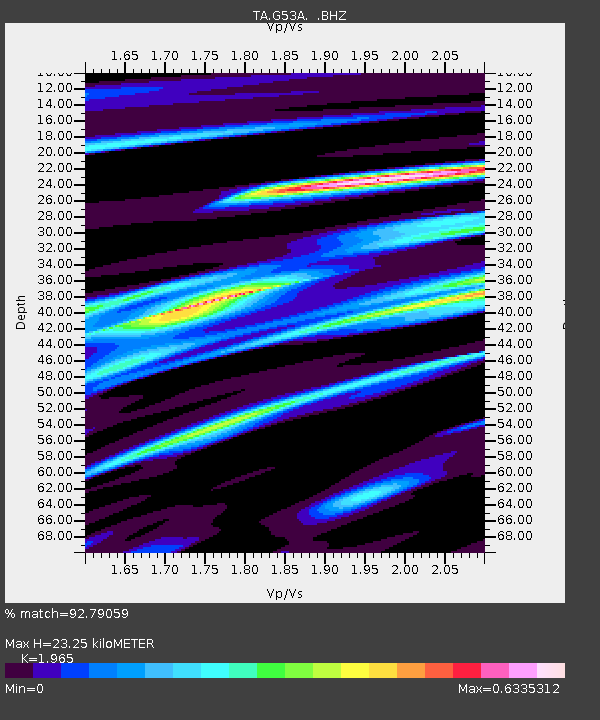
| Channel | StoN | STA | LTA |
| TA:G53A: :BHZ:20130821T12:44:33.950Z | 8.668259 | 1.2929919E-6 | 1.4916398E-7 |
| TA:G53A: :BHN:20130821T12:44:33.950Z | 1.5950656 | 7.1270097E-7 | 4.468161E-7 |
| TA:G53A: :BHE:20130821T12:44:33.950Z | 0.94418114 | 6.276464E-7 | 6.6475206E-7 |
| Arrivals | |
| Ps | 3.7 SECOND |
| PpPs | 9.7 SECOND |
| PsPs/PpSs | 13 SECOND |

