
G57A Newington, ON, CAN - Earthquake Result Viewer
| ||||||||||||||||||
| ||||||||||||||||||
| ||||||||||||||||||
|
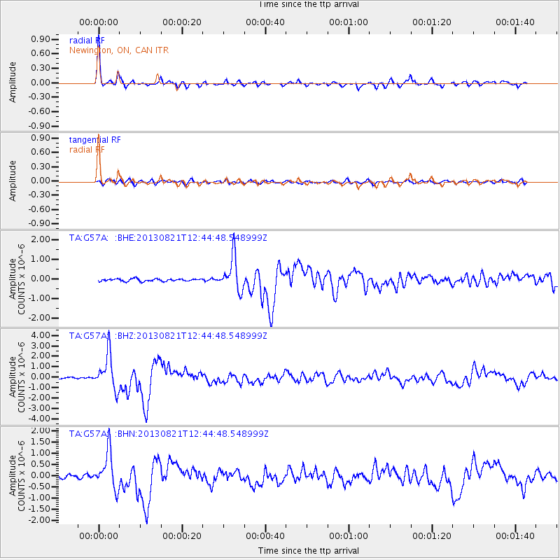
Signal To Noise
| Channel | StoN | STA | LTA |
| TA:G57A: :BHZ:20130821T12:44:48.548999Z | 11.62065 | 1.7557805E-6 | 1.5109143E-7 |
| TA:G57A: :BHN:20130821T12:44:48.548999Z | 11.503485 | 8.572468E-7 | 7.452062E-8 |
| TA:G57A: :BHE:20130821T12:44:48.548999Z | 14.396937 | 8.9079265E-7 | 6.187376E-8 |
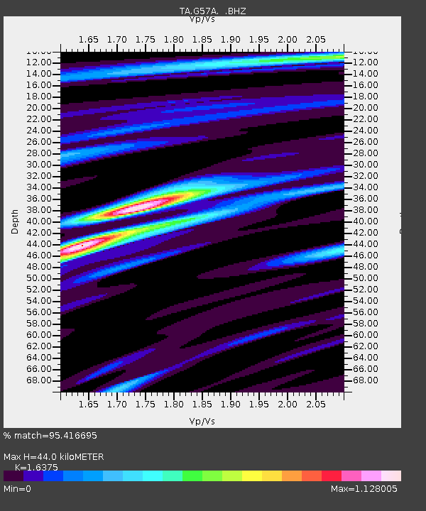
| Arrivals | |
| Ps | 4.7 SECOND |
| PpPs | 17 SECOND |
| PsPs/PpSs | 21 SECOND |

