G58A Ormstown, QC, CAN - Earthquake Result Viewer
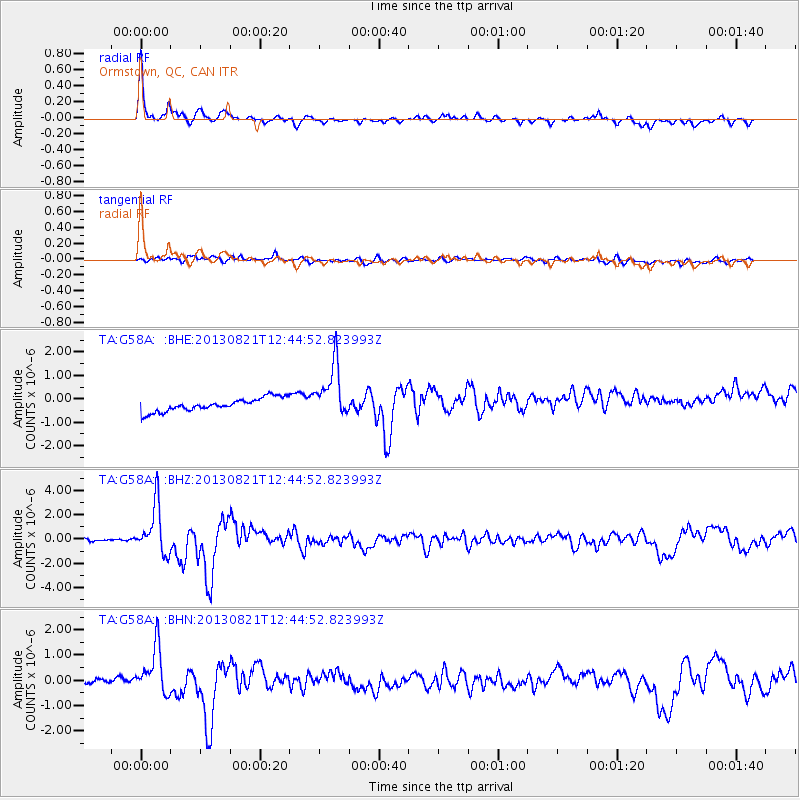
Earthquake location: Near Coast Of Guerrero, Mexico
Earthquake latitude/longitude: 16.9/-99.5
Earthquake time(UTC): 2013/08/21 (233) 12:38:29 GMT
Earthquake Depth: 21 km
Earthquake Magnitude: 6.2 MWW, 6.2 MWW, 6.2 MWB, 6.2 MWC
Earthquake Catalog/Contributor: NEIC PDE/NEIC COMCAT
Network: TA USArray Transportable Network (new EarthScope stations)
Station: G58A Ormstown, QC, CAN
Lat/Lon: 45.15 N/74.05 W
Elevation: 53 m
Distance: 35.3 deg
Az: 31.707 deg
Baz: 225.326 deg
Ray Param: 0.07724785
Estimated Moho Depth: 31.5 km
Estimated Crust Vp/Vs: 1.86
Assumed Crust Vp: 6.419 km/s
Estimated Crust Vs: 3.447 km/s
Estimated Crust Poisson's Ratio: 0.30
Radial Match: 90.48284 %
Radial Bump: 352
Transverse Match: 65.2019 %
Transverse Bump: 400
SOD ConfigId: 626651
Insert Time: 2014-04-18 02:08:57.984 +0000
GWidth: 2.5
Max Bumps: 400
Tol: 0.001

Signal To Noise

ChannelStoNSTALTA
TA:G58A: :BHZ:20130821T12:44:52.823993Z28.4490622.0095258E-67.063592E-8
TA:G58A: :BHN:20130821T12:44:52.823993Z9.2107529.5288885E-71.0345397E-7
TA:G58A: :BHE:20130821T12:44:52.823993Z4.07700871.1558242E-62.8349808E-7
Arrivals
Ps4.5 SECOND
PpPs13 SECOND
PsPs/PpSs18 SECOND