
H47A Mio, MI, USA - Earthquake Result Viewer
| ||||||||||||||||||
| ||||||||||||||||||
| ||||||||||||||||||
|
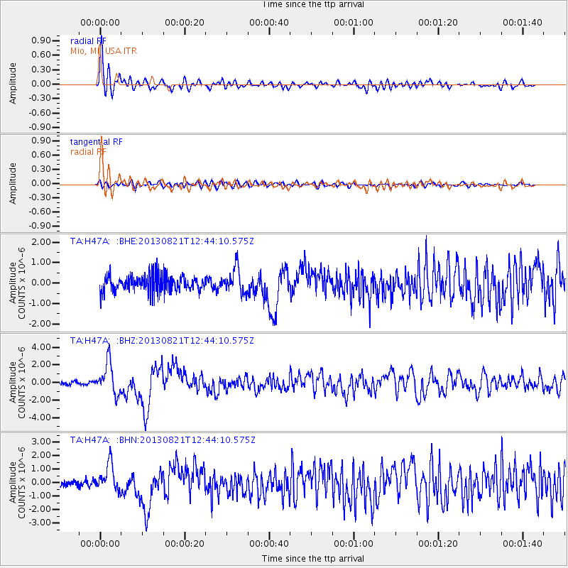
Signal To Noise
| Channel | StoN | STA | LTA |
| TA:H47A: :BHZ:20130821T12:44:10.575Z | 8.911053 | 1.83775E-6 | 2.0623266E-7 |
| TA:H47A: :BHN:20130821T12:44:10.575Z | 3.8321428 | 1.0371039E-6 | 2.7063288E-7 |
| TA:H47A: :BHE:20130821T12:44:10.575Z | 1.5419177 | 6.0845446E-7 | 3.9460892E-7 |
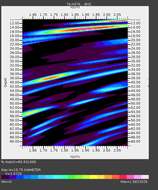
| Arrivals | |
| Ps | 1.9 SECOND |
| PpPs | 4.8 SECOND |
| PsPs/PpSs | 6.7 SECOND |

