I48A Sherman Twp, MI, USA - Earthquake Result Viewer
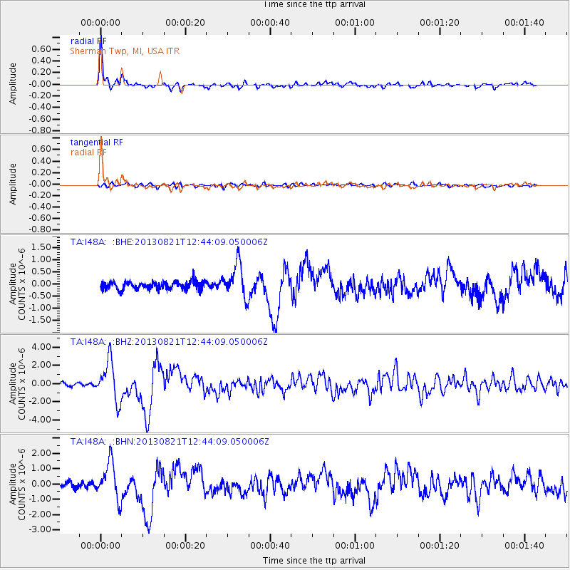
Earthquake location: Near Coast Of Guerrero, Mexico
Earthquake latitude/longitude: 16.9/-99.5
Earthquake time(UTC): 2013/08/21 (233) 12:38:29 GMT
Earthquake Depth: 21 km
Earthquake Magnitude: 6.2 MWW, 6.2 MWW, 6.2 MWB, 6.2 MWC
Earthquake Catalog/Contributor: NEIC PDE/NEIC COMCAT
Network: TA USArray Transportable Network (new EarthScope stations)
Station: I48A Sherman Twp, MI, USA
Lat/Lon: 44.19 N/83.70 W
Elevation: 192 m
Distance: 30.3 deg
Az: 22.825 deg
Baz: 211.083 deg
Ray Param: 0.07934936
Estimated Moho Depth: 32.25 km
Estimated Crust Vp/Vs: 1.99
Assumed Crust Vp: 6.483 km/s
Estimated Crust Vs: 3.254 km/s
Estimated Crust Poisson's Ratio: 0.33
Radial Match: 95.453514 %
Radial Bump: 370
Transverse Match: 66.95855 %
Transverse Bump: 400
SOD ConfigId: 626651
Insert Time: 2014-04-18 02:09:43.815 +0000
GWidth: 2.5
Max Bumps: 400
Tol: 0.001

Signal To Noise

ChannelStoNSTALTA
TA:I48A: :BHZ:20130821T12:44:09.050006Z15.0460812.29212E-61.5234001E-7
TA:I48A: :BHN:20130821T12:44:09.050006Z8.5781881.2488499E-61.4558435E-7
TA:I48A: :BHE:20130821T12:44:09.050006Z4.29338557.171411E-71.6703395E-7
Arrivals
Ps5.3 SECOND
PpPs14 SECOND
PsPs/PpSs19 SECOND