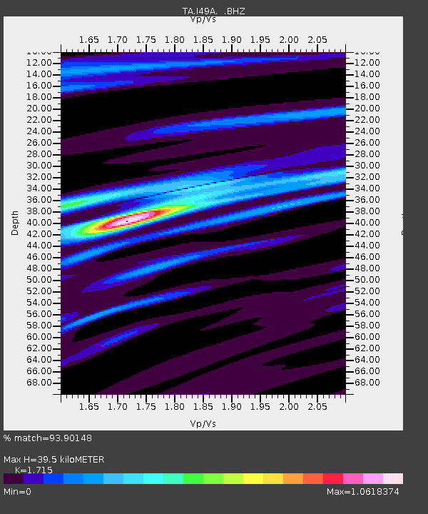
I49A Point Hope, MI, USA - Earthquake Result Viewer

Earthquake location: Near Coast Of Guerrero, Mexico
Earthquake latitude/longitude: 16.9/-99.5
Earthquake time(UTC): 2013/08/21 (233) 12:38:29 GMT
Earthquake Depth: 21 km
Earthquake Magnitude: 6.2 MWW, 6.2 MWW, 6.2 MWB, 6.2 MWC
Earthquake Catalog/Contributor: NEIC PDE/NEIC COMCAT
Network: TA USArray Transportable Network (new EarthScope stations)
Station: I49A Point Hope, MI, USA
Lat/Lon: 43.94 N/82.82 W
Elevation: 217 m
Distance: 30.4 deg
Az: 24.145 deg
Baz: 212.83 deg
Ray Param: 0.07931651
Estimated Moho Depth: 39.5 km
Estimated Crust Vp/Vs: 1.72
Assumed Crust Vp: 6.483 km/s
Estimated Crust Vs: 3.78 km/s
Estimated Crust Poisson's Ratio: 0.24
Radial Match: 93.90148 %
Radial Bump: 362
Transverse Match: 70.96414 %
Transverse Bump: 400
SOD ConfigId: 626651
Insert Time: 2014-04-18 02:09:48.397 +0000
GWidth: 2.5
Max Bumps: 400
Tol: 0.001

Signal To Noise

ChannelStoNSTALTA
TA:I49A: :BHZ:20130821T12:44:10.150012Z7.43007761.9504935E-62.6251323E-7
TA:I49A: :BHN:20130821T12:44:10.150012Z5.62345171.0991366E-61.9545587E-7
TA:I49A: :BHE:20130821T12:44:10.150012Z6.29365.8794274E-79.341914E-8
Arrivals
Ps4.7 SECOND
PpPs15 SECOND
PsPs/PpSs20 SECOND