J54A Appleton, NY, USA - Earthquake Result Viewer
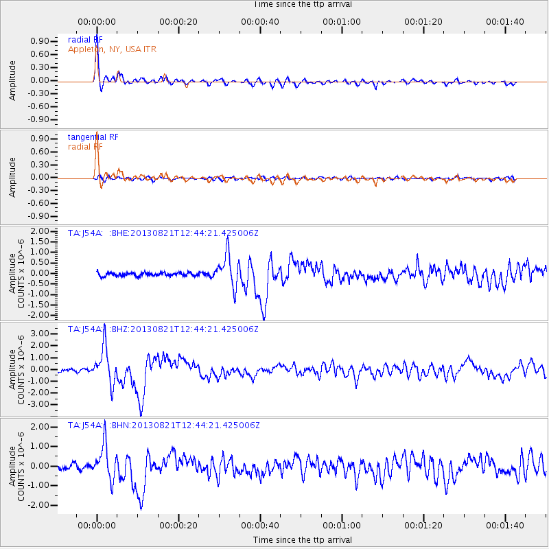
Earthquake location: Near Coast Of Guerrero, Mexico
Earthquake latitude/longitude: 16.9/-99.5
Earthquake time(UTC): 2013/08/21 (233) 12:38:29 GMT
Earthquake Depth: 21 km
Earthquake Magnitude: 6.2 MWW, 6.2 MWW, 6.2 MWB, 6.2 MWC
Earthquake Catalog/Contributor: NEIC PDE/NEIC COMCAT
Network: TA USArray Transportable Network (new EarthScope stations)
Station: J54A Appleton, NY, USA
Lat/Lon: 43.27 N/78.64 W
Elevation: 112 m
Distance: 31.7 deg
Az: 29.642 deg
Baz: 220.416 deg
Ray Param: 0.07893294
Estimated Moho Depth: 42.75 km
Estimated Crust Vp/Vs: 1.75
Assumed Crust Vp: 6.419 km/s
Estimated Crust Vs: 3.673 km/s
Estimated Crust Poisson's Ratio: 0.26
Radial Match: 94.81549 %
Radial Bump: 362
Transverse Match: 69.602806 %
Transverse Bump: 400
SOD ConfigId: 626651
Insert Time: 2014-04-18 02:10:10.517 +0000
GWidth: 2.5
Max Bumps: 400
Tol: 0.001

Signal To Noise

ChannelStoNSTALTA
TA:J54A: :BHZ:20130821T12:44:21.425006Z14.0512911.5995079E-61.13833515E-7
TA:J54A: :BHN:20130821T12:44:21.425006Z7.2865269.1318026E-71.2532449E-7
TA:J54A: :BHE:20130821T12:44:21.425006Z9.901127.853291E-77.9317196E-8
Arrivals
Ps5.4 SECOND
PpPs17 SECOND
PsPs/PpSs22 SECOND