You are here: Home > Network List > TA - USArray Transportable Network (new EarthScope stations) Stations List
> Station K04D Chiloquin, OR, USA > Earthquake Result Viewer
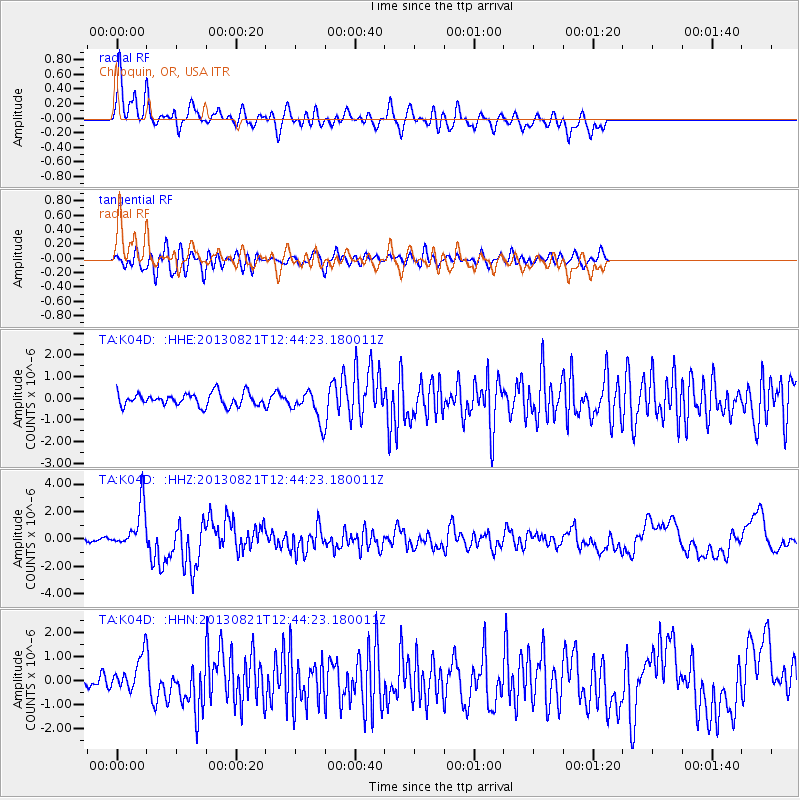
K04D Chiloquin, OR, USA - Earthquake Result Viewer
*The percent match for this event was below the threshold and hence no stack was calculated.
| Earthquake location: |
Near Coast Of Guerrero, Mexico |
| Earthquake latitude/longitude: |
16.9/-99.5 |
| Earthquake time(UTC): |
2013/08/21 (233) 12:38:29 GMT |
| Earthquake Depth: |
21 km |
| Earthquake Magnitude: |
6.2 MWW, 6.2 MWW, 6.2 MWB, 6.2 MWC |
| Earthquake Catalog/Contributor: |
NEIC PDE/NEIC COMCAT |
|
| Network: |
TA USArray Transportable Network (new EarthScope stations) |
| Station: |
K04D Chiloquin, OR, USA |
| Lat/Lon: |
42.62 N/121.75 W |
| Elevation: |
1315 m |
|
| Distance: |
31.9 deg |
| Az: |
328.09 deg |
| Baz: |
136.708 deg |
| Ray Param: |
$rayparam |
*The percent match for this event was below the threshold and hence was not used in the summary stack. |
|
| Radial Match: |
78.57445 % |
| Radial Bump: |
400 |
| Transverse Match: |
65.93829 % |
| Transverse Bump: |
400 |
| SOD ConfigId: |
626651 |
| Insert Time: |
2014-04-18 02:10:26.029 +0000 |
| GWidth: |
2.5 |
| Max Bumps: |
400 |
| Tol: |
0.001 |
|
Signal To Noise
| Channel | StoN | STA | LTA |
| TA:K04D: :HHZ:20130821T12:44:23.180011Z | 9.431464 | 1.59943E-6 | 1.695845E-7 |
| TA:K04D: :HHN:20130821T12:44:23.180011Z | 2.5996382 | 6.9249177E-7 | 2.6638006E-7 |
| TA:K04D: :HHE:20130821T12:44:23.180011Z | 2.3403811 | 6.8522183E-7 | 2.9278218E-7 |
| Arrivals |
| Ps | |
| PpPs | |
| PsPs/PpSs | |


