L54A Sinclairville, NY, USA - Earthquake Result Viewer
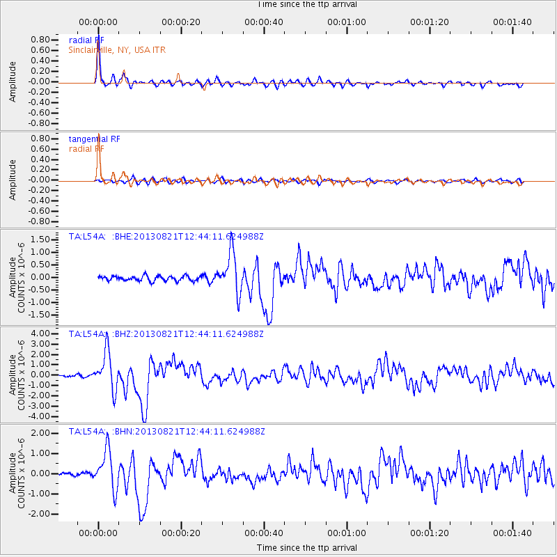
Earthquake location: Near Coast Of Guerrero, Mexico
Earthquake latitude/longitude: 16.9/-99.5
Earthquake time(UTC): 2013/08/21 (233) 12:38:29 GMT
Earthquake Depth: 21 km
Earthquake Magnitude: 6.2 MWW, 6.2 MWW, 6.2 MWB, 6.2 MWC
Earthquake Catalog/Contributor: NEIC PDE/NEIC COMCAT
Network: TA USArray Transportable Network (new EarthScope stations)
Station: L54A Sinclairville, NY, USA
Lat/Lon: 42.23 N/79.32 W
Elevation: 432 m
Distance: 30.6 deg
Az: 30.209 deg
Baz: 220.443 deg
Ray Param: 0.07927277
Estimated Moho Depth: 48.5 km
Estimated Crust Vp/Vs: 1.75
Assumed Crust Vp: 6.419 km/s
Estimated Crust Vs: 3.668 km/s
Estimated Crust Poisson's Ratio: 0.26
Radial Match: 95.09108 %
Radial Bump: 360
Transverse Match: 76.410965 %
Transverse Bump: 400
SOD ConfigId: 626651
Insert Time: 2014-04-18 02:10:52.900 +0000
GWidth: 2.5
Max Bumps: 400
Tol: 0.001

Signal To Noise

ChannelStoNSTALTA
TA:L54A: :BHZ:20130821T12:44:11.624988Z16.548451.9134995E-61.1563014E-7
TA:L54A: :BHN:20130821T12:44:11.624988Z11.9111629.962554E-78.364049E-8
TA:L54A: :BHE:20130821T12:44:11.624988Z8.590618.3744015E-79.748321E-8
Arrivals
Ps6.1 SECOND
PpPs19 SECOND
PsPs/PpSs25 SECOND