N56A West Decatur, PA, USA - Earthquake Result Viewer
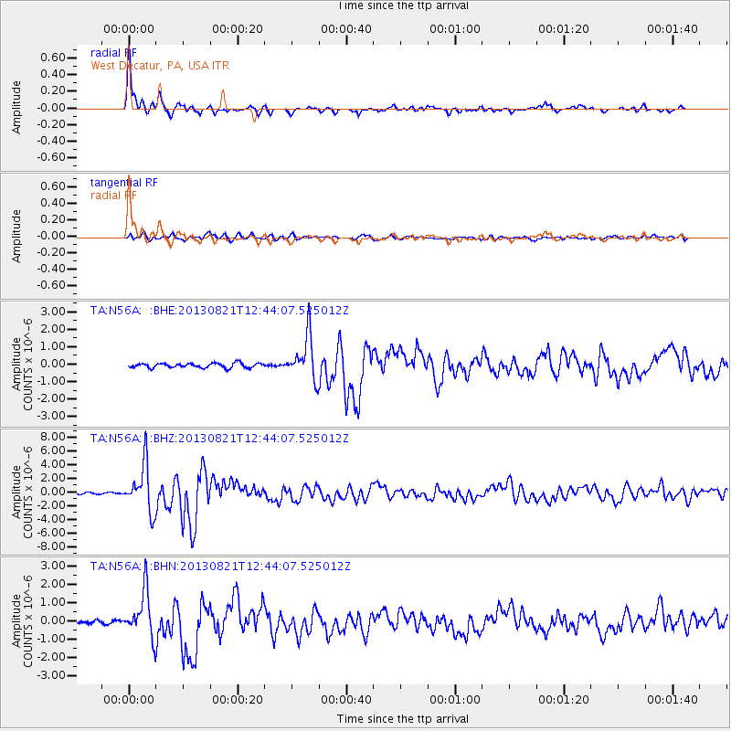
Earthquake location: Near Coast Of Guerrero, Mexico
Earthquake latitude/longitude: 16.9/-99.5
Earthquake time(UTC): 2013/08/21 (233) 12:38:29 GMT
Earthquake Depth: 21 km
Earthquake Magnitude: 6.2 MWW, 6.2 MWW, 6.2 MWB, 6.2 MWC
Earthquake Catalog/Contributor: NEIC PDE/NEIC COMCAT
Network: TA USArray Transportable Network (new EarthScope stations)
Station: N56A West Decatur, PA, USA
Lat/Lon: 40.92 N/78.30 W
Elevation: 561 m
Distance: 30.1 deg
Az: 33.076 deg
Baz: 223.592 deg
Ray Param: 0.07939499
Estimated Moho Depth: 12.0 km
Estimated Crust Vp/Vs: 2.10
Assumed Crust Vp: 6.121 km/s
Estimated Crust Vs: 2.918 km/s
Estimated Crust Poisson's Ratio: 0.35
Radial Match: 97.11896 %
Radial Bump: 338
Transverse Match: 82.00525 %
Transverse Bump: 400
SOD ConfigId: 626651
Insert Time: 2014-04-18 02:11:36.493 +0000
GWidth: 2.5
Max Bumps: 400
Tol: 0.001

Signal To Noise

ChannelStoNSTALTA
TA:N56A: :BHZ:20130821T12:44:07.525012Z28.506673.433309E-61.204388E-7
TA:N56A: :BHN:20130821T12:44:07.525012Z14.2224581.263594E-68.884498E-8
TA:N56A: :BHE:20130821T12:44:07.525012Z9.6466841.2521126E-61.2979721E-7
Arrivals
Ps2.3 SECOND
PpPs5.7 SECOND
PsPs/PpSs8.0 SECOND