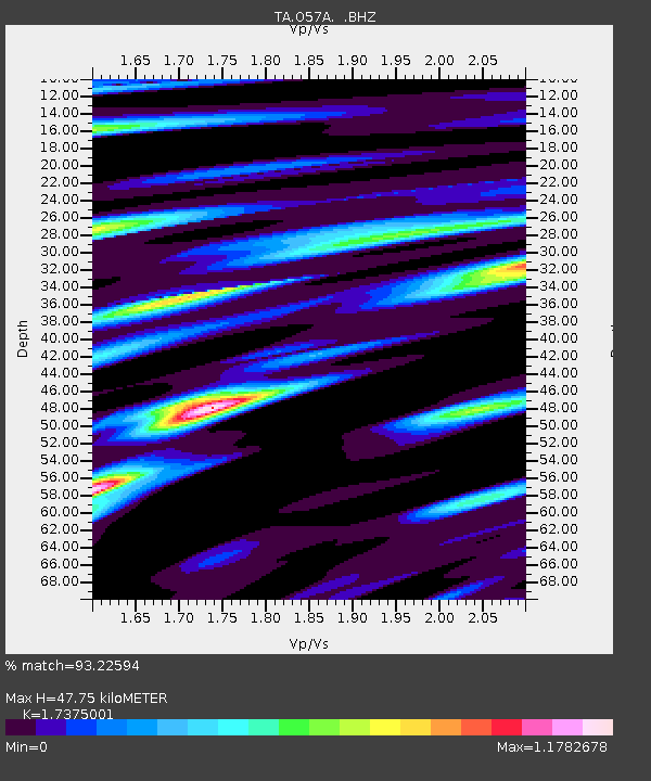
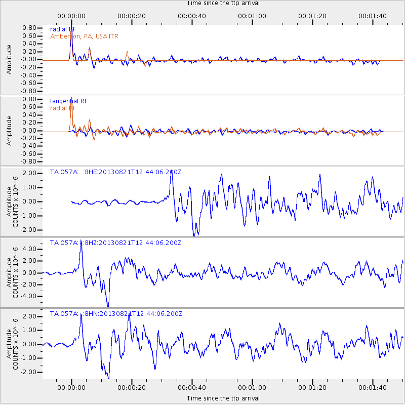
O57A Amberson, PA, USA - Earthquake Result Viewer

Earthquake location: Near Coast Of Guerrero, Mexico
Earthquake latitude/longitude: 16.9/-99.5
Earthquake time(UTC): 2013/08/21 (233) 12:38:29 GMT
Earthquake Depth: 21 km
Earthquake Magnitude: 6.2 MWW, 6.2 MWW, 6.2 MWB, 6.2 MWC
Earthquake Catalog/Contributor: NEIC PDE/NEIC COMCAT
Network: TA USArray Transportable Network (new EarthScope stations)
Station: O57A Amberson, PA, USA
Lat/Lon: 40.21 N/77.64 W
Elevation: 377 m
Distance: 30.0 deg
Az: 34.78 deg
Baz: 225.494 deg
Ray Param: 0.07943452
Estimated Moho Depth: 47.75 km
Estimated Crust Vp/Vs: 1.74
Assumed Crust Vp: 6.121 km/s
Estimated Crust Vs: 3.523 km/s
Estimated Crust Poisson's Ratio: 0.25
Radial Match: 93.22594 %
Radial Bump: 400
Transverse Match: 72.03632 %
Transverse Bump: 400
SOD ConfigId: 626651
Insert Time: 2014-04-18 02:12:01.767 +0000
GWidth: 2.5
Max Bumps: 400
Tol: 0.001

Signal To Noise

ChannelStoNSTALTA
TA:O57A: :BHZ:20130821T12:44:06.200Z17.7459932.0418995E-61.1506256E-7
TA:O57A: :BHN:20130821T12:44:06.200Z11.0594178.056571E-77.284807E-8
TA:O57A: :BHE:20130821T12:44:06.200Z9.523878.969192E-79.417591E-8
Arrivals
Ps6.2 SECOND
PpPs20 SECOND
PsPs/PpSs26 SECOND