O60A Telford, PA, USA - Earthquake Result Viewer
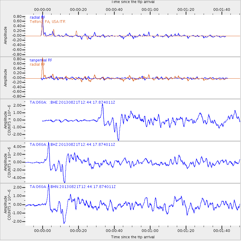
Earthquake location: Near Coast Of Guerrero, Mexico
Earthquake latitude/longitude: 16.9/-99.5
Earthquake time(UTC): 2013/08/21 (233) 12:38:29 GMT
Earthquake Depth: 21 km
Earthquake Magnitude: 6.2 MWW, 6.2 MWW, 6.2 MWB, 6.2 MWC
Earthquake Catalog/Contributor: NEIC PDE/NEIC COMCAT
Network: TA USArray Transportable Network (new EarthScope stations)
Station: O60A Telford, PA, USA
Lat/Lon: 40.32 N/75.40 W
Elevation: 70 m
Distance: 31.3 deg
Az: 36.903 deg
Baz: 228.757 deg
Ray Param: 0.0790868
Estimated Moho Depth: 37.0 km
Estimated Crust Vp/Vs: 1.94
Assumed Crust Vp: 6.283 km/s
Estimated Crust Vs: 3.243 km/s
Estimated Crust Poisson's Ratio: 0.32
Radial Match: 95.629585 %
Radial Bump: 327
Transverse Match: 79.18101 %
Transverse Bump: 400
SOD ConfigId: 626651
Insert Time: 2014-04-18 02:12:10.828 +0000
GWidth: 2.5
Max Bumps: 400
Tol: 0.001

Signal To Noise

ChannelStoNSTALTA
TA:O60A: :BHZ:20130821T12:44:17.874011Z28.1534861.9444599E-66.9066395E-8
TA:O60A: :BHN:20130821T12:44:17.874011Z14.5521038.8967744E-76.113738E-8
TA:O60A: :BHE:20130821T12:44:17.874011Z11.0341328.8008676E-77.97604E-8
Arrivals
Ps5.9 SECOND
PpPs16 SECOND
PsPs/PpSs22 SECOND