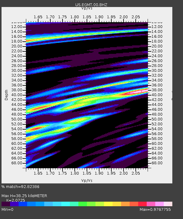
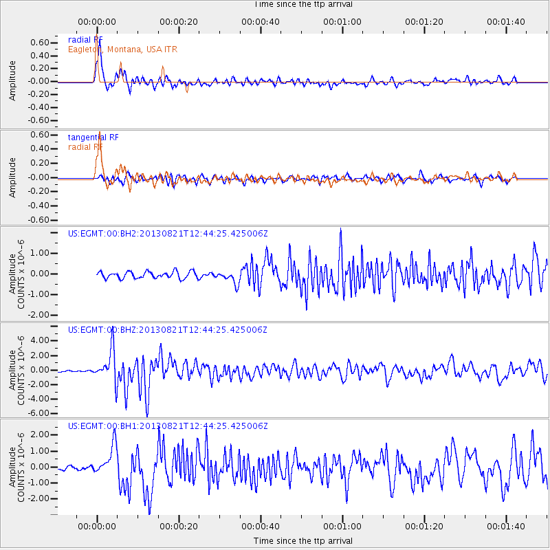
EGMT Eagleton, Montana, USA - Earthquake Result Viewer

Earthquake location: Near Coast Of Guerrero, Mexico
Earthquake latitude/longitude: 16.9/-99.5
Earthquake time(UTC): 2013/08/21 (233) 12:38:29 GMT
Earthquake Depth: 21 km
Earthquake Magnitude: 6.2 MWW, 6.2 MWW, 6.2 MWB, 6.2 MWC
Earthquake Catalog/Contributor: NEIC PDE/NEIC COMCAT
Network: US United States National Seismic Network
Station: EGMT Eagleton, Montana, USA
Lat/Lon: 48.02 N/109.75 W
Elevation: 1055 m
Distance: 32.2 deg
Az: 347.031 deg
Baz: 161.332 deg
Ray Param: 0.07873805
Estimated Moho Depth: 38.25 km
Estimated Crust Vp/Vs: 2.07
Assumed Crust Vp: 6.438 km/s
Estimated Crust Vs: 3.106 km/s
Estimated Crust Poisson's Ratio: 0.35
Radial Match: 92.82386 %
Radial Bump: 400
Transverse Match: 70.04619 %
Transverse Bump: 400
SOD ConfigId: 626651
Insert Time: 2014-04-18 02:13:21.227 +0000
GWidth: 2.5
Max Bumps: 400
Tol: 0.001

Signal To Noise

ChannelStoNSTALTA
US:EGMT:00:BHZ:20130821T12:44:25.425006Z31.6088942.2497388E-67.1174235E-8
US:EGMT:00:BH1:20130821T12:44:25.425006Z11.3240549.57203E-78.4528295E-8
US:EGMT:00:BH2:20130821T12:44:25.425006Z1.93445093.1307746E-71.6184306E-7
Arrivals
Ps6.8 SECOND
PpPs17 SECOND
PsPs/PpSs24 SECOND