
LONY Lake Ozonia, New York, USA - Earthquake Result Viewer
| ||||||||||||||||||
| ||||||||||||||||||
| ||||||||||||||||||
|
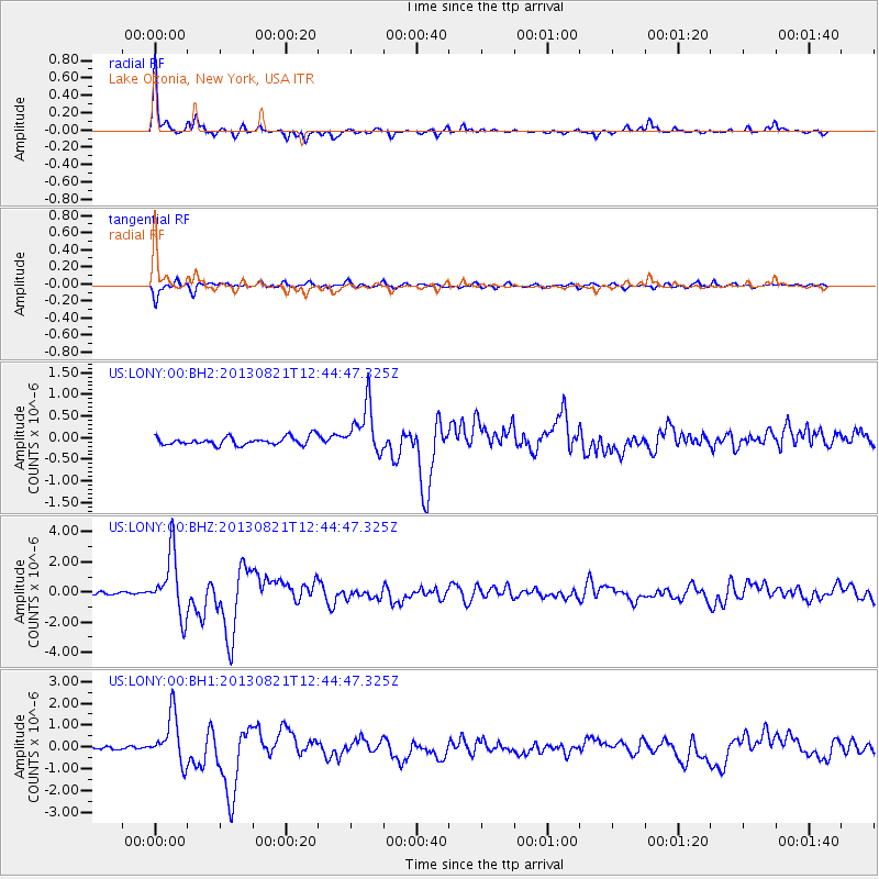
Signal To Noise
| Channel | StoN | STA | LTA |
| US:LONY:00:BHZ:20130821T12:44:47.325Z | 18.542425 | 2.013261E-6 | 1.0857594E-7 |
| US:LONY:00:BH1:20130821T12:44:47.325Z | 18.253088 | 1.0989949E-6 | 6.0208706E-8 |
| US:LONY:00:BH2:20130821T12:44:47.325Z | 6.053628 | 5.7134304E-7 | 9.4380276E-8 |
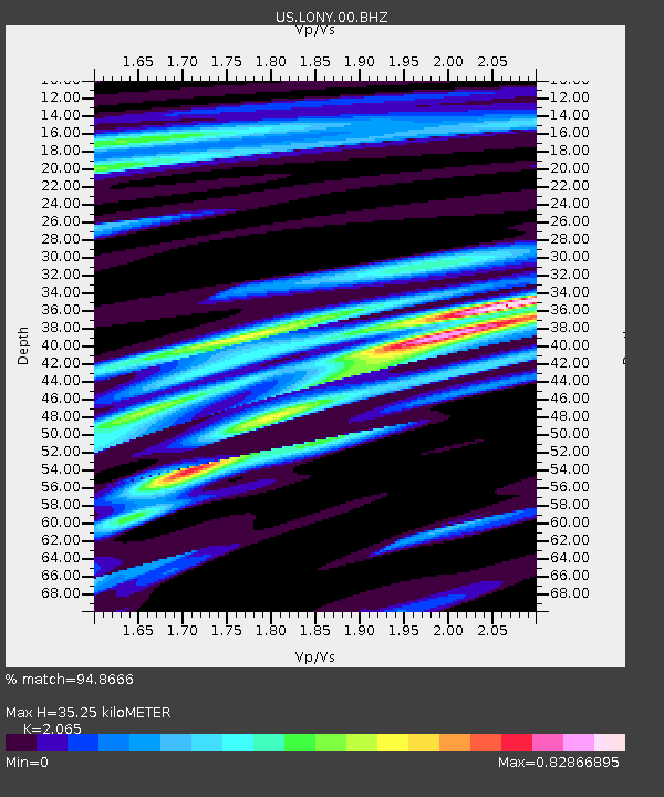
| Arrivals | |
| Ps | 6.2 SECOND |
| PpPs | 16 SECOND |
| PsPs/PpSs | 22 SECOND |

