PKME Peaks-Kenny State Park, Maine, USA - Earthquake Result Viewer
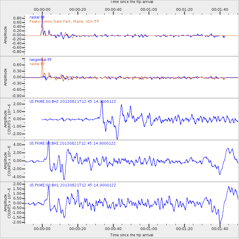
Earthquake location: Near Coast Of Guerrero, Mexico
Earthquake latitude/longitude: 16.9/-99.5
Earthquake time(UTC): 2013/08/21 (233) 12:38:29 GMT
Earthquake Depth: 21 km
Earthquake Magnitude: 6.2 MWW, 6.2 MWW, 6.2 MWB, 6.2 MWC
Earthquake Catalog/Contributor: NEIC PDE/NEIC COMCAT
Network: US United States National Seismic Network
Station: PKME Peaks-Kenny State Park, Maine, USA
Lat/Lon: 45.26 N/69.29 W
Elevation: 108 m
Distance: 37.9 deg
Az: 35.303 deg
Baz: 231.582 deg
Ray Param: 0.07582171
Estimated Moho Depth: 25.25 km
Estimated Crust Vp/Vs: 1.97
Assumed Crust Vp: 6.419 km/s
Estimated Crust Vs: 3.267 km/s
Estimated Crust Poisson's Ratio: 0.33
Radial Match: 94.77112 %
Radial Bump: 316
Transverse Match: 77.979385 %
Transverse Bump: 400
SOD ConfigId: 626651
Insert Time: 2014-04-18 02:13:56.089 +0000
GWidth: 2.5
Max Bumps: 400
Tol: 0.001

Signal To Noise

ChannelStoNSTALTA
US:PKME:00:BHZ:20130821T12:45:14.900012Z16.5306971.8949423E-61.14631725E-7
US:PKME:00:BH1:20130821T12:45:14.900012Z8.1333196.9235296E-78.512551E-8
US:PKME:00:BH2:20130821T12:45:14.900012Z12.065228.9469876E-77.4155196E-8
Arrivals
Ps4.1 SECOND
PpPs11 SECOND
PsPs/PpSs15 SECOND