LON Longmire (broad-band and DWWSSN) - Earthquake Result Viewer
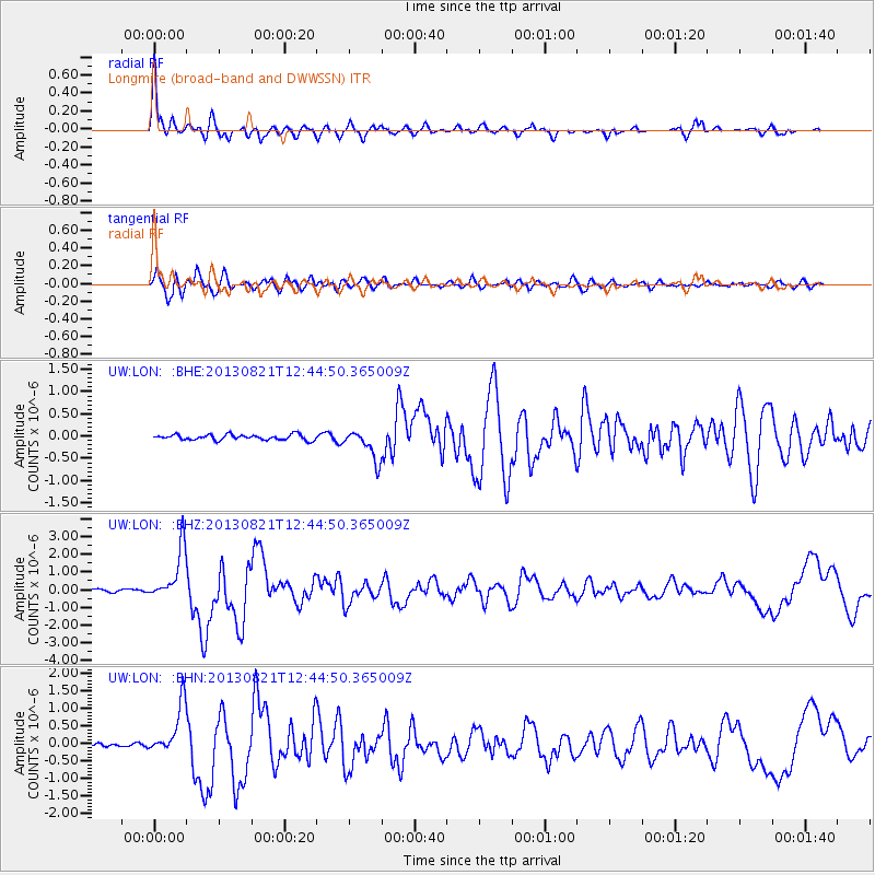
Earthquake location: Near Coast Of Guerrero, Mexico
Earthquake latitude/longitude: 16.9/-99.5
Earthquake time(UTC): 2013/08/21 (233) 12:38:29 GMT
Earthquake Depth: 21 km
Earthquake Magnitude: 6.2 MWW, 6.2 MWW, 6.2 MWB, 6.2 MWC
Earthquake Catalog/Contributor: NEIC PDE/NEIC COMCAT
Network: UW Pacific Northwest Regional Seismic Network
Station: LON Longmire (broad-band and DWWSSN)
Lat/Lon: 46.75 N/121.81 W
Elevation: 850 m
Distance: 35.1 deg
Az: 332.967 deg
Baz: 140.738 deg
Ray Param: 0.07739608
Estimated Moho Depth: 23.75 km
Estimated Crust Vp/Vs: 1.69
Assumed Crust Vp: 6.597 km/s
Estimated Crust Vs: 3.904 km/s
Estimated Crust Poisson's Ratio: 0.23
Radial Match: 91.03004 %
Radial Bump: 400
Transverse Match: 87.03604 %
Transverse Bump: 400
SOD ConfigId: 626651
Insert Time: 2014-04-18 02:14:43.799 +0000
GWidth: 2.5
Max Bumps: 400
Tol: 0.001

Signal To Noise

ChannelStoNSTALTA
UW:LON: :BHZ:20130821T12:44:50.365009Z15.6806541.4529091E-69.265616E-8
UW:LON: :BHN:20130821T12:44:50.365009Z11.2246657.1904464E-76.4059336E-8
UW:LON: :BHE:20130821T12:44:50.365009Z5.80882263.450838E-75.9406844E-8
Arrivals
Ps2.7 SECOND
PpPs8.9 SECOND
PsPs/PpSs12 SECOND