You are here: Home > Network List > KN - Kyrgyz Seismic Telemetry Network Stations List
> Station TKM2 - > Earthquake Result Viewer
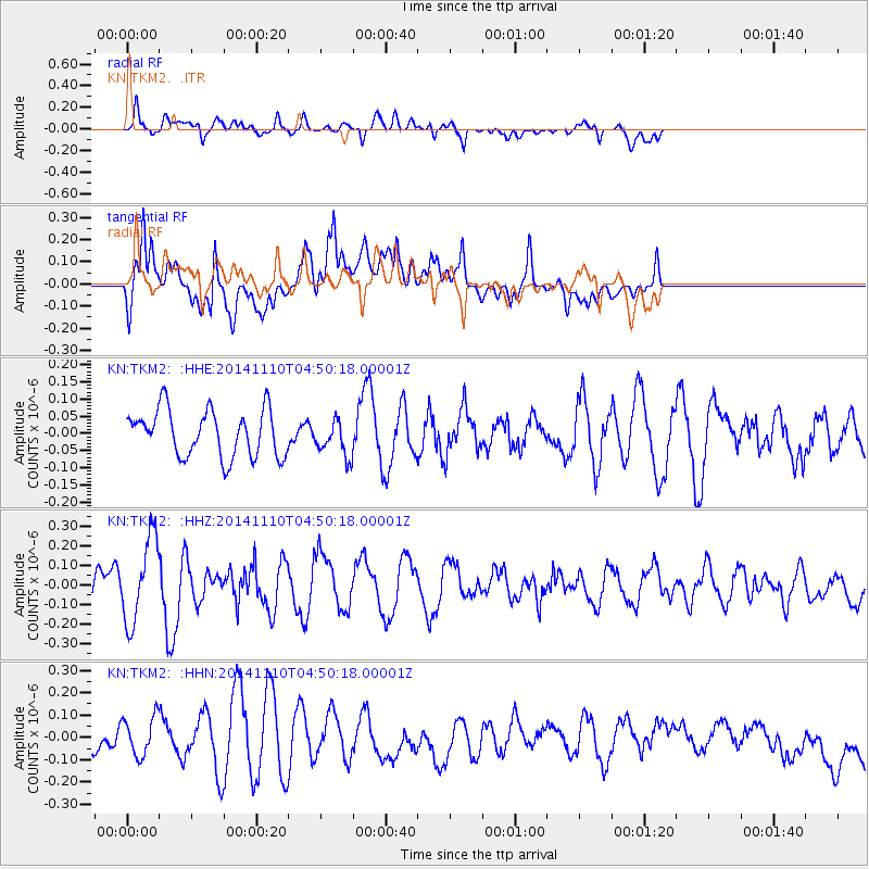
TKM2 - - Earthquake Result Viewer
*The percent match for this event was below the threshold and hence no stack was calculated.
| Earthquake location: |
Philippine Islands Region |
| Earthquake latitude/longitude: |
10.0/126.8 |
| Earthquake time(UTC): |
2014/11/10 (314) 04:41:21 GMT |
| Earthquake Depth: |
64 km |
| Earthquake Magnitude: |
5.5 MB |
| Earthquake Catalog/Contributor: |
NEIC PDE/NEIC COMCAT |
|
| Network: |
KN Kyrgyz Seismic Telemetry Network |
| Station: |
TKM2 - |
| Lat/Lon: |
42.92 N/75.60 E |
| Elevation: |
2020 m |
|
| Distance: |
55.2 deg |
| Az: |
315.778 deg |
| Baz: |
110.755 deg |
| Ray Param: |
$rayparam |
*The percent match for this event was below the threshold and hence was not used in the summary stack. |
|
| Radial Match: |
58.1749 % |
| Radial Bump: |
400 |
| Transverse Match: |
67.054405 % |
| Transverse Bump: |
400 |
| SOD ConfigId: |
3390531 |
| Insert Time: |
2019-04-14 22:06:18.238 +0000 |
| GWidth: |
2.5 |
| Max Bumps: |
400 |
| Tol: |
0.001 |
|
Signal To Noise
| Channel | StoN | STA | LTA |
| KN:TKM2: :HHZ:20141110T04:50:18.00001Z | 2.1792753 | 2.1477038E-7 | 9.855128E-8 |
| KN:TKM2: :HHN:20141110T04:50:18.00001Z | 1.6892351 | 1.01320715E-7 | 5.998023E-8 |
| KN:TKM2: :HHE:20141110T04:50:18.00001Z | 0.69079566 | 4.704214E-8 | 6.809849E-8 |
| Arrivals |
| Ps | |
| PpPs | |
| PsPs/PpSs | |


