You are here: Home > Network List > TA - USArray Transportable Network (new EarthScope stations) Stations List
> Station V60A Jim Taylor Road, Stokes, NC, USA > Earthquake Result Viewer
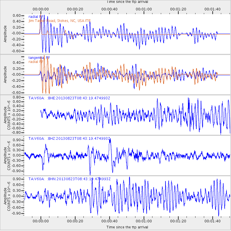
V60A Jim Taylor Road, Stokes, NC, USA - Earthquake Result Viewer
*The percent match for this event was below the threshold and hence no stack was calculated.
| Earthquake location: |
Northern Chile |
| Earthquake latitude/longitude: |
-22.3/-68.6 |
| Earthquake time(UTC): |
2013/08/23 (235) 08:34:06 GMT |
| Earthquake Depth: |
111 km |
| Earthquake Magnitude: |
5.8 MWW, 5.7 MWD, 5.8 MWW, 5.8 MWB, 5.8 MWC |
| Earthquake Catalog/Contributor: |
NEIC PDE/NEIC COMCAT |
|
| Network: |
TA USArray Transportable Network (new EarthScope stations) |
| Station: |
V60A Jim Taylor Road, Stokes, NC, USA |
| Lat/Lon: |
35.76 N/77.26 W |
| Elevation: |
8.0 m |
|
| Distance: |
58.3 deg |
| Az: |
351.715 deg |
| Baz: |
170.554 deg |
| Ray Param: |
$rayparam |
*The percent match for this event was below the threshold and hence was not used in the summary stack. |
|
| Radial Match: |
79.053246 % |
| Radial Bump: |
400 |
| Transverse Match: |
71.559814 % |
| Transverse Bump: |
400 |
| SOD ConfigId: |
626651 |
| Insert Time: |
2014-04-18 02:57:00.940 +0000 |
| GWidth: |
2.5 |
| Max Bumps: |
400 |
| Tol: |
0.001 |
|
Signal To Noise
| Channel | StoN | STA | LTA |
| TA:V60A: :BHZ:20130823T08:43:19.474993Z | 4.417346 | 3.5268846E-7 | 7.984171E-8 |
| TA:V60A: :BHN:20130823T08:43:19.474993Z | 1.5707455 | 2.1030827E-7 | 1.3389074E-7 |
| TA:V60A: :BHE:20130823T08:43:19.474993Z | 1.6209241 | 1.9586669E-7 | 1.2083643E-7 |
| Arrivals |
| Ps | |
| PpPs | |
| PsPs/PpSs | |


