You are here: Home > Network List > TA - USArray Transportable Network (new EarthScope stations) Stations List
> Station L04D Klamath Falls, OR, USA > Earthquake Result Viewer
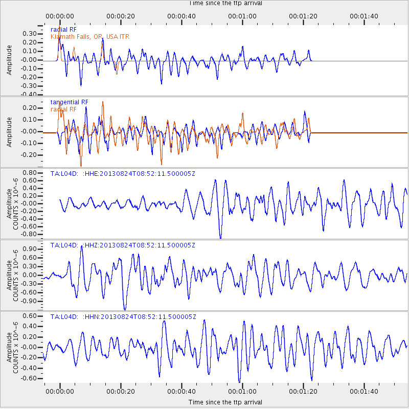
L04D Klamath Falls, OR, USA - Earthquake Result Viewer
*The percent match for this event was below the threshold and hence no stack was calculated.
| Earthquake location: |
Tonga Islands Region |
| Earthquake latitude/longitude: |
-22.5/-175.2 |
| Earthquake time(UTC): |
2013/08/24 (236) 08:40:28 GMT |
| Earthquake Depth: |
5.0 km |
| Earthquake Magnitude: |
5.8 MWW, 5.7 MWC, 5.8 MWW, 5.8 MWB |
| Earthquake Catalog/Contributor: |
NEIC PDE/NEIC COMCAT |
|
| Network: |
TA USArray Transportable Network (new EarthScope stations) |
| Station: |
L04D Klamath Falls, OR, USA |
| Lat/Lon: |
42.22 N/122.30 W |
| Elevation: |
1437 m |
|
| Distance: |
80.8 deg |
| Az: |
36.899 deg |
| Baz: |
228.363 deg |
| Ray Param: |
$rayparam |
*The percent match for this event was below the threshold and hence was not used in the summary stack. |
|
| Radial Match: |
76.97265 % |
| Radial Bump: |
400 |
| Transverse Match: |
67.77481 % |
| Transverse Bump: |
400 |
| SOD ConfigId: |
626651 |
| Insert Time: |
2014-04-18 03:29:40.369 +0000 |
| GWidth: |
2.5 |
| Max Bumps: |
400 |
| Tol: |
0.001 |
|
Signal To Noise
| Channel | StoN | STA | LTA |
| TA:L04D: :HHZ:20130824T08:52:11.500005Z | 2.0557477 | 2.1777039E-7 | 1.0593244E-7 |
| TA:L04D: :HHN:20130824T08:52:11.500005Z | 0.7580843 | 9.1459E-8 | 1.206449E-7 |
| TA:L04D: :HHE:20130824T08:52:11.500005Z | 0.74808127 | 6.335891E-8 | 8.469522E-8 |
| Arrivals |
| Ps | |
| PpPs | |
| PsPs/PpSs | |


