You are here: Home > Network List > US - United States National Seismic Network Stations List
> Station HAWA Hanford, Washington, USA > Earthquake Result Viewer
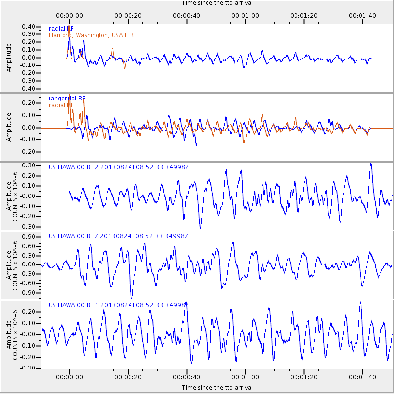
HAWA Hanford, Washington, USA - Earthquake Result Viewer
*The percent match for this event was below the threshold and hence no stack was calculated.
| Earthquake location: |
Tonga Islands Region |
| Earthquake latitude/longitude: |
-22.5/-175.2 |
| Earthquake time(UTC): |
2013/08/24 (236) 08:40:28 GMT |
| Earthquake Depth: |
5.0 km |
| Earthquake Magnitude: |
5.8 MWW, 5.7 MWC, 5.8 MWW, 5.8 MWB |
| Earthquake Catalog/Contributor: |
NEIC PDE/NEIC COMCAT |
|
| Network: |
US United States National Seismic Network |
| Station: |
HAWA Hanford, Washington, USA |
| Lat/Lon: |
46.39 N/119.53 W |
| Elevation: |
364 m |
|
| Distance: |
85.1 deg |
| Az: |
35.026 deg |
| Baz: |
230.065 deg |
| Ray Param: |
$rayparam |
*The percent match for this event was below the threshold and hence was not used in the summary stack. |
|
| Radial Match: |
78.49797 % |
| Radial Bump: |
400 |
| Transverse Match: |
73.795334 % |
| Transverse Bump: |
400 |
| SOD ConfigId: |
626651 |
| Insert Time: |
2014-04-18 03:31:56.824 +0000 |
| GWidth: |
2.5 |
| Max Bumps: |
400 |
| Tol: |
0.001 |
|
Signal To Noise
| Channel | StoN | STA | LTA |
| US:HAWA:00:BHZ:20130824T08:52:33.34998Z | 5.364752 | 2.4528424E-7 | 4.572145E-8 |
| US:HAWA:00:BH1:20130824T08:52:33.34998Z | 1.1422247 | 5.8532304E-8 | 5.1244125E-8 |
| US:HAWA:00:BH2:20130824T08:52:33.34998Z | 1.1007857 | 6.8115455E-8 | 6.187894E-8 |
| Arrivals |
| Ps | |
| PpPs | |
| PsPs/PpSs | |


