You are here: Home > Network List > TA - USArray Transportable Network (new EarthScope stations) Stations List
> Station H63A New Sharon, ME, USA > Earthquake Result Viewer
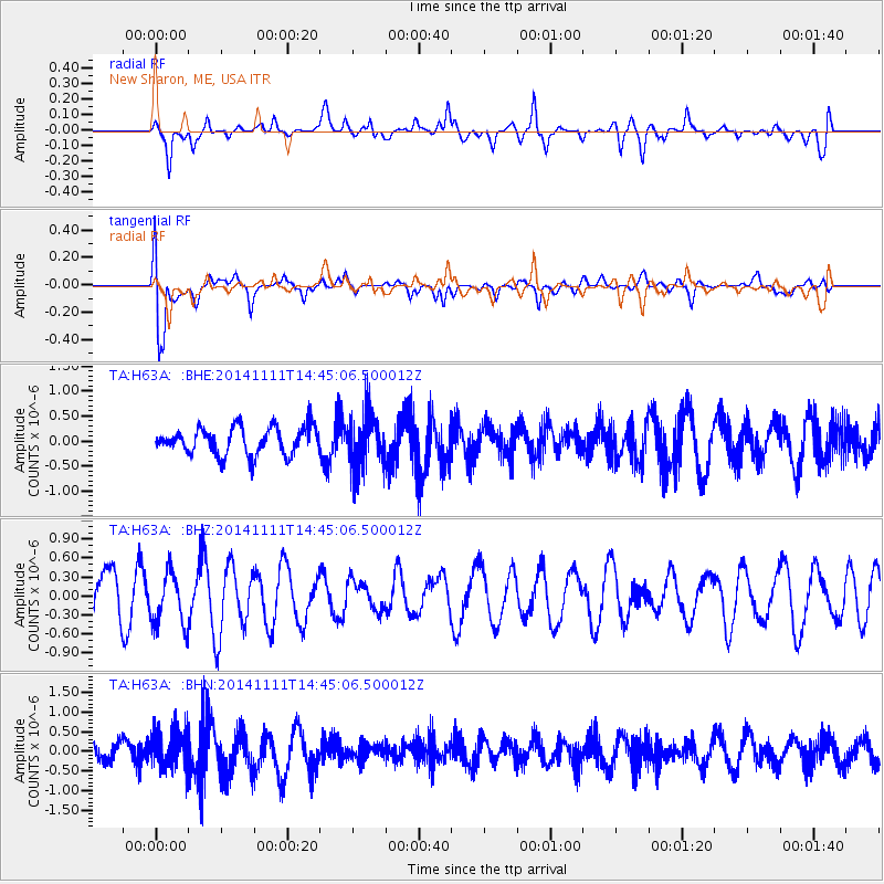
H63A New Sharon, ME, USA - Earthquake Result Viewer
*The percent match for this event was below the threshold and hence no stack was calculated.
| Earthquake location: |
Northwest Of Kuril Islands |
| Earthquake latitude/longitude: |
52.5/152.9 |
| Earthquake time(UTC): |
2014/11/11 (315) 14:34:40 GMT |
| Earthquake Depth: |
499 km |
| Earthquake Magnitude: |
4.7 mb, 4.8 mb |
| Earthquake Catalog/Contributor: |
ISC/ISC |
|
| Network: |
TA USArray Transportable Network (new EarthScope stations) |
| Station: |
H63A New Sharon, ME, USA |
| Lat/Lon: |
44.66 N/70.04 W |
| Elevation: |
109 m |
|
| Distance: |
76.4 deg |
| Az: |
30.037 deg |
| Baz: |
334.612 deg |
| Ray Param: |
$rayparam |
*The percent match for this event was below the threshold and hence was not used in the summary stack. |
|
| Radial Match: |
50.995617 % |
| Radial Bump: |
400 |
| Transverse Match: |
74.61891 % |
| Transverse Bump: |
400 |
| SOD ConfigId: |
3390531 |
| Insert Time: |
2019-04-14 22:52:24.596 +0000 |
| GWidth: |
2.5 |
| Max Bumps: |
400 |
| Tol: |
0.001 |
|
Signal To Noise
| Channel | StoN | STA | LTA |
| TA:H63A: :BHZ:20141111T14:45:06.500012Z | 1.2123708 | 4.226829E-7 | 3.486416E-7 |
| TA:H63A: :BHN:20141111T14:45:06.500012Z | 2.3446147 | 5.029518E-7 | 2.1451365E-7 |
| TA:H63A: :BHE:20141111T14:45:06.500012Z | 2.0108216 | 5.4912954E-7 | 2.7308718E-7 |
| Arrivals |
| Ps | |
| PpPs | |
| PsPs/PpSs | |


