You are here: Home > Network List > TA - USArray Transportable Network (new EarthScope stations) Stations List
> Station L04D Klamath Falls, OR, USA > Earthquake Result Viewer
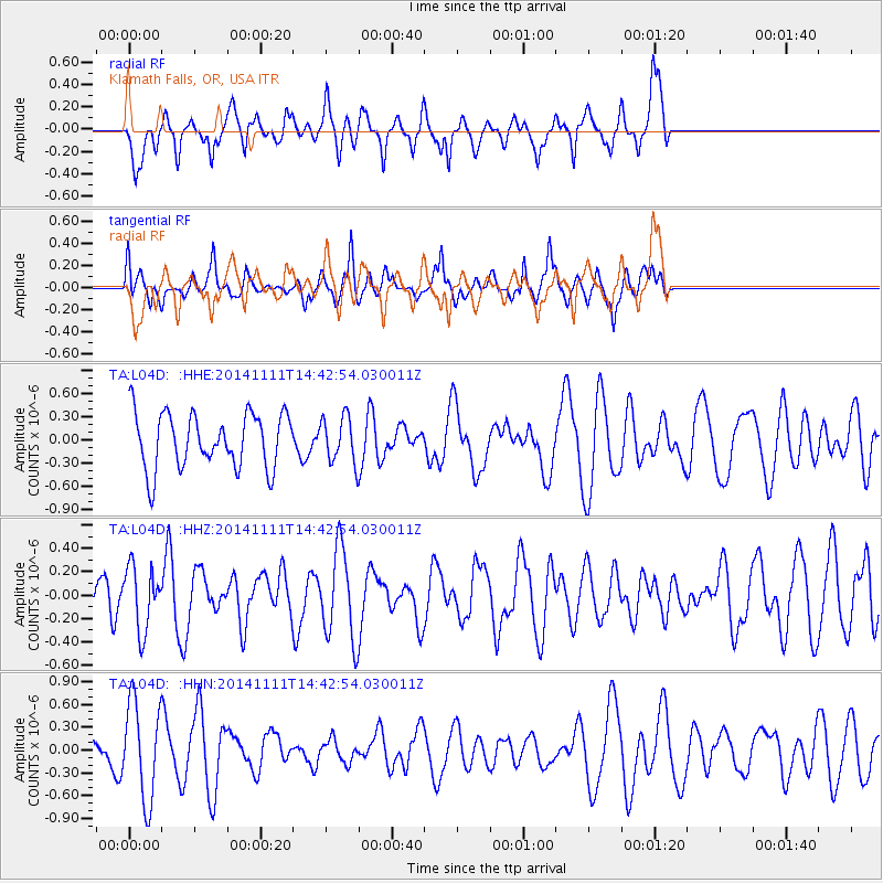
L04D Klamath Falls, OR, USA - Earthquake Result Viewer
*The percent match for this event was below the threshold and hence no stack was calculated.
| Earthquake location: |
Northwest Of Kuril Islands |
| Earthquake latitude/longitude: |
52.5/152.9 |
| Earthquake time(UTC): |
2014/11/11 (315) 14:34:40 GMT |
| Earthquake Depth: |
499 km |
| Earthquake Magnitude: |
4.7 mb, 4.8 mb |
| Earthquake Catalog/Contributor: |
ISC/ISC |
|
| Network: |
TA USArray Transportable Network (new EarthScope stations) |
| Station: |
L04D Klamath Falls, OR, USA |
| Lat/Lon: |
42.22 N/122.30 W |
| Elevation: |
1437 m |
|
| Distance: |
55.2 deg |
| Az: |
64.336 deg |
| Baz: |
312.126 deg |
| Ray Param: |
$rayparam |
*The percent match for this event was below the threshold and hence was not used in the summary stack. |
|
| Radial Match: |
60.90986 % |
| Radial Bump: |
335 |
| Transverse Match: |
58.46702 % |
| Transverse Bump: |
374 |
| SOD ConfigId: |
3390531 |
| Insert Time: |
2019-04-14 22:52:32.290 +0000 |
| GWidth: |
2.5 |
| Max Bumps: |
400 |
| Tol: |
0.001 |
|
Signal To Noise
| Channel | StoN | STA | LTA |
| TA:L04D: :HHZ:20141111T14:42:54.030011Z | 1.1045626 | 2.6986064E-7 | 2.4431446E-7 |
| TA:L04D: :HHN:20141111T14:42:54.030011Z | 1.568242 | 6.383733E-7 | 4.07063E-7 |
| TA:L04D: :HHE:20141111T14:42:54.030011Z | 0.81877875 | 2.930005E-7 | 3.5785064E-7 |
| Arrivals |
| Ps | |
| PpPs | |
| PsPs/PpSs | |


