You are here: Home > Network List > TA - USArray Transportable Network (new EarthScope stations) Stations List
> Station P59A Jarrettsville, MD, USA > Earthquake Result Viewer
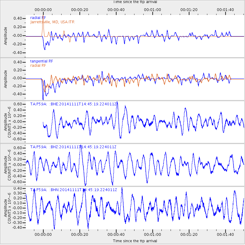
P59A Jarrettsville, MD, USA - Earthquake Result Viewer
*The percent match for this event was below the threshold and hence no stack was calculated.
| Earthquake location: |
Northwest Of Kuril Islands |
| Earthquake latitude/longitude: |
52.5/152.9 |
| Earthquake time(UTC): |
2014/11/11 (315) 14:34:40 GMT |
| Earthquake Depth: |
499 km |
| Earthquake Magnitude: |
4.7 mb, 4.8 mb |
| Earthquake Catalog/Contributor: |
ISC/ISC |
|
| Network: |
TA USArray Transportable Network (new EarthScope stations) |
| Station: |
P59A Jarrettsville, MD, USA |
| Lat/Lon: |
39.61 N/76.43 W |
| Elevation: |
157 m |
|
| Distance: |
78.7 deg |
| Az: |
36.715 deg |
| Baz: |
331.769 deg |
| Ray Param: |
$rayparam |
*The percent match for this event was below the threshold and hence was not used in the summary stack. |
|
| Radial Match: |
48.128506 % |
| Radial Bump: |
400 |
| Transverse Match: |
53.51979 % |
| Transverse Bump: |
400 |
| SOD ConfigId: |
3390531 |
| Insert Time: |
2019-04-14 22:52:46.123 +0000 |
| GWidth: |
2.5 |
| Max Bumps: |
400 |
| Tol: |
0.001 |
|
Signal To Noise
| Channel | StoN | STA | LTA |
| TA:P59A: :BHZ:20141111T14:45:19.224011Z | 0.73074174 | 1.4414277E-7 | 1.9725543E-7 |
| TA:P59A: :BHN:20141111T14:45:19.224011Z | 0.8322278 | 1.51324E-7 | 1.8183003E-7 |
| TA:P59A: :BHE:20141111T14:45:19.224011Z | 0.6799357 | 1.4237715E-7 | 2.0939797E-7 |
| Arrivals |
| Ps | |
| PpPs | |
| PsPs/PpSs | |


