You are here: Home > Network List > G - GEOSCOPE Stations List
> Station INU Inuyama, Japan > Earthquake Result Viewer
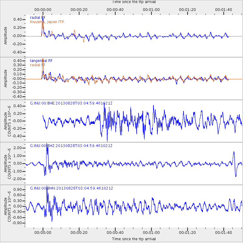
INU Inuyama, Japan - Earthquake Result Viewer
*The percent match for this event was below the threshold and hence no stack was calculated.
| Earthquake location: |
Kermadec Islands Region |
| Earthquake latitude/longitude: |
-27.8/179.6 |
| Earthquake time(UTC): |
2013/08/28 (240) 02:54:41 GMT |
| Earthquake Depth: |
478 km |
| Earthquake Magnitude: |
6.2 MWW, 6.2 MWW, 6.2 MWB, 6.2 MWC, 6.3 MWC |
| Earthquake Catalog/Contributor: |
NEIC PDE/NEIC COMCAT |
|
| Network: |
G GEOSCOPE |
| Station: |
INU Inuyama, Japan |
| Lat/Lon: |
35.35 N/137.03 E |
| Elevation: |
132 m |
|
| Distance: |
74.6 deg |
| Az: |
324.967 deg |
| Baz: |
141.524 deg |
| Ray Param: |
$rayparam |
*The percent match for this event was below the threshold and hence was not used in the summary stack. |
|
| Radial Match: |
70.368 % |
| Radial Bump: |
342 |
| Transverse Match: |
58.8241 % |
| Transverse Bump: |
309 |
| SOD ConfigId: |
626651 |
| Insert Time: |
2014-04-18 03:57:19.693 +0000 |
| GWidth: |
2.5 |
| Max Bumps: |
400 |
| Tol: |
0.001 |
|
Signal To Noise
| Channel | StoN | STA | LTA |
| G:INU:00:BHZ:20130828T03:04:59.461021Z | 10.350073 | 9.977555E-7 | 9.640081E-8 |
| G:INU:00:BHN:20130828T03:04:59.461021Z | 3.59841 | 3.7651293E-7 | 1.0463314E-7 |
| G:INU:00:BHE:20130828T03:04:59.461021Z | 2.925531 | 2.0460256E-7 | 6.9936895E-8 |
| Arrivals |
| Ps | |
| PpPs | |
| PsPs/PpSs | |


