You are here: Home > Network List > US - United States National Seismic Network Stations List
> Station EGMT Eagleton, Montana, USA > Earthquake Result Viewer
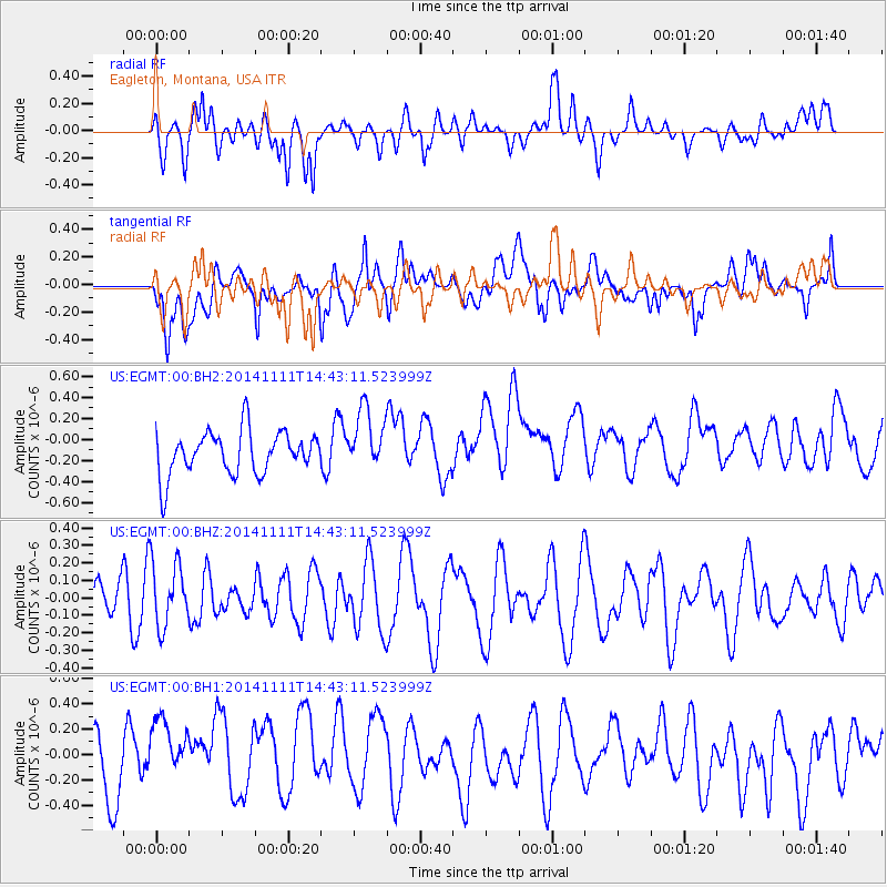
EGMT Eagleton, Montana, USA - Earthquake Result Viewer
*The percent match for this event was below the threshold and hence no stack was calculated.
| Earthquake location: |
Northwest Of Kuril Islands |
| Earthquake latitude/longitude: |
52.5/152.9 |
| Earthquake time(UTC): |
2014/11/11 (315) 14:34:40 GMT |
| Earthquake Depth: |
499 km |
| Earthquake Magnitude: |
4.7 mb, 4.8 mb |
| Earthquake Catalog/Contributor: |
ISC/ISC |
|
| Network: |
US United States National Seismic Network |
| Station: |
EGMT Eagleton, Montana, USA |
| Lat/Lon: |
48.02 N/109.75 W |
| Elevation: |
1055 m |
|
| Distance: |
57.7 deg |
| Az: |
51.982 deg |
| Baz: |
314.165 deg |
| Ray Param: |
$rayparam |
*The percent match for this event was below the threshold and hence was not used in the summary stack. |
|
| Radial Match: |
50.945877 % |
| Radial Bump: |
400 |
| Transverse Match: |
44.863415 % |
| Transverse Bump: |
400 |
| SOD ConfigId: |
3390531 |
| Insert Time: |
2019-04-14 22:53:53.318 +0000 |
| GWidth: |
2.5 |
| Max Bumps: |
400 |
| Tol: |
0.001 |
|
Signal To Noise
| Channel | StoN | STA | LTA |
| US:EGMT:00:BHZ:20141111T14:43:11.523999Z | 1.0972946 | 1.8200866E-7 | 1.6587039E-7 |
| US:EGMT:00:BH1:20141111T14:43:11.523999Z | 1.4079938 | 3.0640734E-7 | 2.1761981E-7 |
| US:EGMT:00:BH2:20141111T14:43:11.523999Z | 1.4183058 | 2.9328822E-7 | 2.0678773E-7 |
| Arrivals |
| Ps | |
| PpPs | |
| PsPs/PpSs | |


