You are here: Home > Network List > AZ - ANZA Regional Network Stations List
> Station SMER AZ.SMER > Earthquake Result Viewer
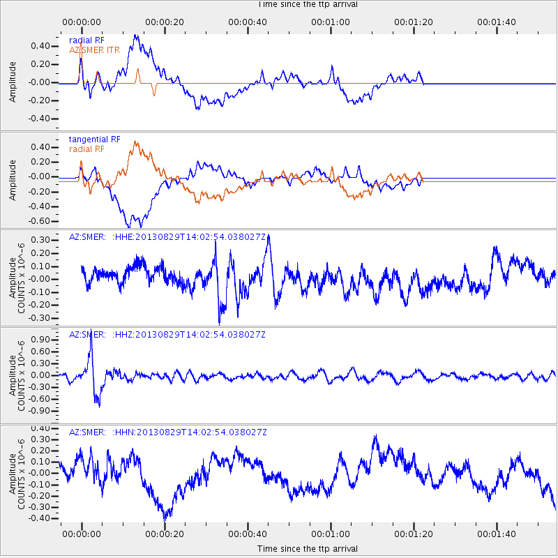
SMER AZ.SMER - Earthquake Result Viewer
*The percent match for this event was below the threshold and hence no stack was calculated.
| Earthquake location: |
Fiji Islands Region |
| Earthquake latitude/longitude: |
-19.4/-179.1 |
| Earthquake time(UTC): |
2013/08/29 (241) 13:52:27 GMT |
| Earthquake Depth: |
662 km |
| Earthquake Magnitude: |
5.7 MWW, 5.7 MWW, 5.8 MWC, 5.8 MWB |
| Earthquake Catalog/Contributor: |
NEIC PDE/NEIC COMCAT |
|
| Network: |
AZ ANZA Regional Network |
| Station: |
SMER AZ.SMER |
| Lat/Lon: |
33.46 N/117.17 W |
| Elevation: |
355 m |
|
| Distance: |
79.0 deg |
| Az: |
48.731 deg |
| Baz: |
238.094 deg |
| Ray Param: |
$rayparam |
*The percent match for this event was below the threshold and hence was not used in the summary stack. |
|
| Radial Match: |
48.569695 % |
| Radial Bump: |
400 |
| Transverse Match: |
37.685043 % |
| Transverse Bump: |
400 |
| SOD ConfigId: |
626651 |
| Insert Time: |
2014-04-18 04:19:17.618 +0000 |
| GWidth: |
2.5 |
| Max Bumps: |
400 |
| Tol: |
0.001 |
|
Signal To Noise
| Channel | StoN | STA | LTA |
| AZ:SMER: :HHZ:20130829T14:02:54.038027Z | 5.627551 | 4.6157143E-7 | 8.2019945E-8 |
| AZ:SMER: :HHN:20130829T14:02:54.038027Z | 1.3001074 | 1.18802085E-7 | 9.137867E-8 |
| AZ:SMER: :HHE:20130829T14:02:54.038027Z | 2.9724412 | 1.7340132E-7 | 5.8336333E-8 |
| Arrivals |
| Ps | |
| PpPs | |
| PsPs/PpSs | |


