You are here: Home > Network List > CN - Canadian National Seismograph Network Stations List
> Station INK INUVIK, NT > Earthquake Result Viewer
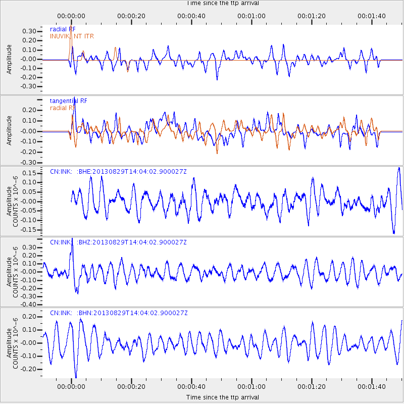
INK INUVIK, NT - Earthquake Result Viewer
*The percent match for this event was below the threshold and hence no stack was calculated.
| Earthquake location: |
Fiji Islands Region |
| Earthquake latitude/longitude: |
-19.4/-179.1 |
| Earthquake time(UTC): |
2013/08/29 (241) 13:52:27 GMT |
| Earthquake Depth: |
662 km |
| Earthquake Magnitude: |
5.7 MWW, 5.7 MWW, 5.8 MWC, 5.8 MWB |
| Earthquake Catalog/Contributor: |
NEIC PDE/NEIC COMCAT |
|
| Network: |
CN Canadian National Seismograph Network |
| Station: |
INK INUVIK, NT |
| Lat/Lon: |
68.31 N/133.53 W |
| Elevation: |
44 m |
|
| Distance: |
93.5 deg |
| Az: |
15.436 deg |
| Baz: |
222.528 deg |
| Ray Param: |
$rayparam |
*The percent match for this event was below the threshold and hence was not used in the summary stack. |
|
| Radial Match: |
47.87102 % |
| Radial Bump: |
400 |
| Transverse Match: |
58.78206 % |
| Transverse Bump: |
400 |
| SOD ConfigId: |
626651 |
| Insert Time: |
2014-04-18 04:21:44.499 +0000 |
| GWidth: |
2.5 |
| Max Bumps: |
400 |
| Tol: |
0.001 |
|
Signal To Noise
| Channel | StoN | STA | LTA |
| CN:INK: :BHZ:20130829T14:04:02.900027Z | 2.601345 | 1.7593722E-7 | 6.7633174E-8 |
| CN:INK: :BHN:20130829T14:04:02.900027Z | 1.8365345 | 1.4759665E-7 | 8.036694E-8 |
| CN:INK: :BHE:20130829T14:04:02.900027Z | 0.73606855 | 4.111357E-8 | 5.5855626E-8 |
| Arrivals |
| Ps | |
| PpPs | |
| PsPs/PpSs | |


