You are here: Home > Network List > IU - Global Seismograph Network (GSN - IRIS/USGS) Stations List
> Station RSSD Black Hills, South Dakota, USA > Earthquake Result Viewer
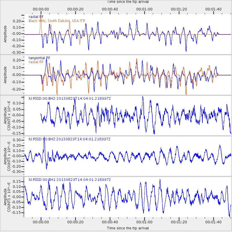
RSSD Black Hills, South Dakota, USA - Earthquake Result Viewer
*The percent match for this event was below the threshold and hence no stack was calculated.
| Earthquake location: |
Fiji Islands Region |
| Earthquake latitude/longitude: |
-19.4/-179.1 |
| Earthquake time(UTC): |
2013/08/29 (241) 13:52:27 GMT |
| Earthquake Depth: |
662 km |
| Earthquake Magnitude: |
5.7 MWW, 5.7 MWW, 5.8 MWC, 5.8 MWB |
| Earthquake Catalog/Contributor: |
NEIC PDE/NEIC COMCAT |
|
| Network: |
IU Global Seismograph Network (GSN - IRIS/USGS) |
| Station: |
RSSD Black Hills, South Dakota, USA |
| Lat/Lon: |
44.12 N/104.04 W |
| Elevation: |
2090 m |
|
| Distance: |
93.1 deg |
| Az: |
44.186 deg |
| Baz: |
246.032 deg |
| Ray Param: |
$rayparam |
*The percent match for this event was below the threshold and hence was not used in the summary stack. |
|
| Radial Match: |
56.287964 % |
| Radial Bump: |
399 |
| Transverse Match: |
54.794506 % |
| Transverse Bump: |
322 |
| SOD ConfigId: |
626651 |
| Insert Time: |
2014-04-18 04:23:56.605 +0000 |
| GWidth: |
2.5 |
| Max Bumps: |
400 |
| Tol: |
0.001 |
|
Signal To Noise
| Channel | StoN | STA | LTA |
| IU:RSSD:00:BHZ:20130829T14:04:01.218997Z | 2.2482207 | 1.3793375E-7 | 6.135241E-8 |
| IU:RSSD:00:BH1:20130829T14:04:01.218997Z | 1.0717281 | 8.330079E-8 | 7.772568E-8 |
| IU:RSSD:00:BH2:20130829T14:04:01.218997Z | 1.1321301 | 5.9688574E-8 | 5.2722367E-8 |
| Arrivals |
| Ps | |
| PpPs | |
| PsPs/PpSs | |


