You are here: Home > Network List > TA - USArray Transportable Network (new EarthScope stations) Stations List
> Station Q56A Snyder Ridge, Maysville, WV, USA > Earthquake Result Viewer
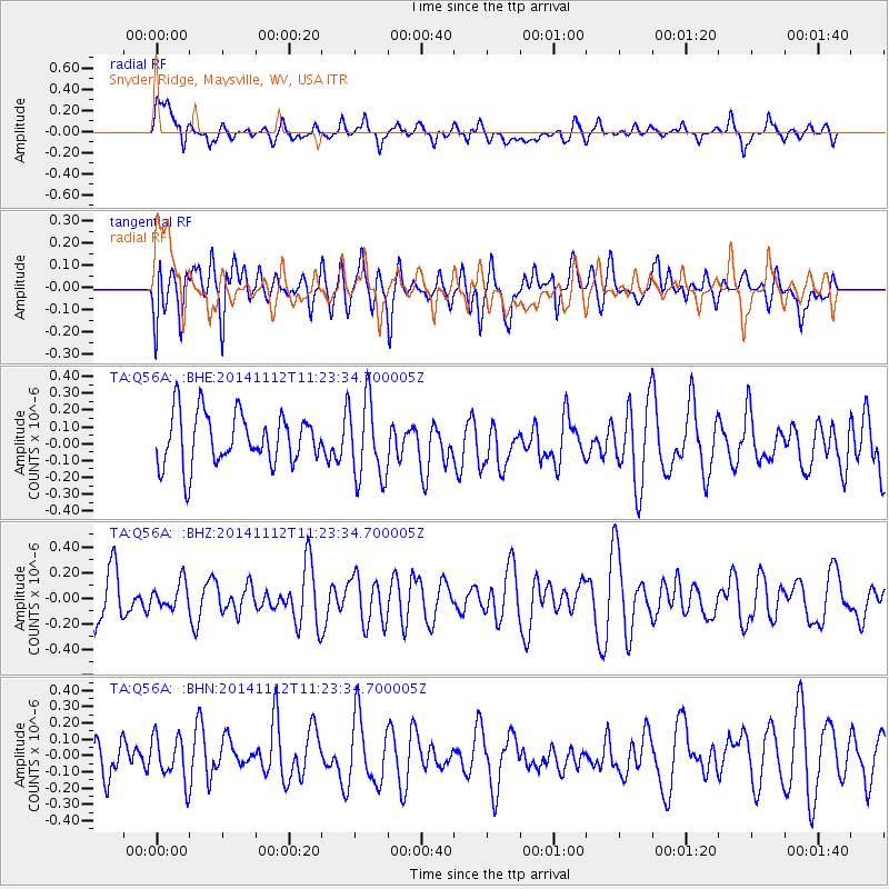
Q56A Snyder Ridge, Maysville, WV, USA - Earthquake Result Viewer
*The percent match for this event was below the threshold and hence no stack was calculated.
| Earthquake location: |
Off Coast Of Ecuador |
| Earthquake latitude/longitude: |
1.2/-85.4 |
| Earthquake time(UTC): |
2014/11/12 (316) 11:16:46 GMT |
| Earthquake Depth: |
10 km |
| Earthquake Magnitude: |
5.5 MW, 4.6 mb, 4.8 MS |
| Earthquake Catalog/Contributor: |
ISC/ISC |
|
| Network: |
TA USArray Transportable Network (new EarthScope stations) |
| Station: |
Q56A Snyder Ridge, Maysville, WV, USA |
| Lat/Lon: |
39.04 N/79.19 W |
| Elevation: |
430 m |
|
| Distance: |
38.1 deg |
| Az: |
7.862 deg |
| Baz: |
190.115 deg |
| Ray Param: |
$rayparam |
*The percent match for this event was below the threshold and hence was not used in the summary stack. |
|
| Radial Match: |
48.682255 % |
| Radial Bump: |
400 |
| Transverse Match: |
59.669476 % |
| Transverse Bump: |
400 |
| SOD ConfigId: |
3390531 |
| Insert Time: |
2019-04-14 23:06:31.354 +0000 |
| GWidth: |
2.5 |
| Max Bumps: |
400 |
| Tol: |
0.001 |
|
Signal To Noise
| Channel | StoN | STA | LTA |
| TA:Q56A: :BHZ:20141112T11:23:34.700005Z | 0.4911313 | 9.987512E-8 | 2.0335727E-7 |
| TA:Q56A: :BHN:20141112T11:23:34.700005Z | 0.66912884 | 1.3974099E-7 | 2.0884018E-7 |
| TA:Q56A: :BHE:20141112T11:23:34.700005Z | 1.5568705 | 2.3618274E-7 | 1.5170353E-7 |
| Arrivals |
| Ps | |
| PpPs | |
| PsPs/PpSs | |


