You are here: Home > Network List > AZ - ANZA Regional Network Stations List
> Station SMER AZ.SMER > Earthquake Result Viewer
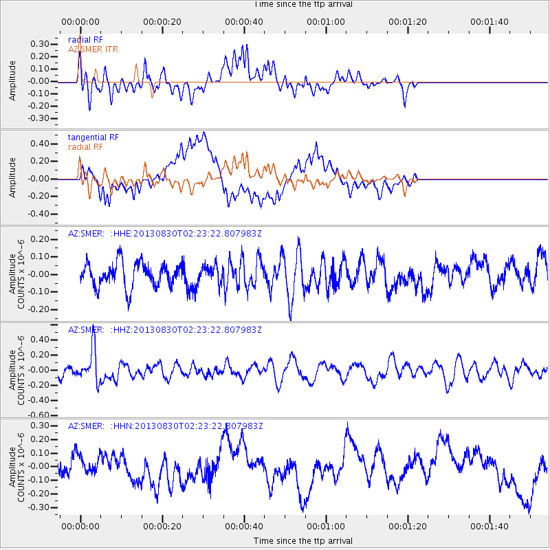
SMER AZ.SMER - Earthquake Result Viewer
*The percent match for this event was below the threshold and hence no stack was calculated.
| Earthquake location: |
New Britain Region, P.N.G. |
| Earthquake latitude/longitude: |
-4.4/151.6 |
| Earthquake time(UTC): |
2013/08/30 (242) 02:11:02 GMT |
| Earthquake Depth: |
203 km |
| Earthquake Magnitude: |
5.8 MWW, 5.8 MWB, 5.8 MWC, 5.8 MWW, 5.9 MWC |
| Earthquake Catalog/Contributor: |
NEIC PDE/NEIC COMCAT |
|
| Network: |
AZ ANZA Regional Network |
| Station: |
SMER AZ.SMER |
| Lat/Lon: |
33.46 N/117.17 W |
| Elevation: |
355 m |
|
| Distance: |
93.4 deg |
| Az: |
56.857 deg |
| Baz: |
266.975 deg |
| Ray Param: |
$rayparam |
*The percent match for this event was below the threshold and hence was not used in the summary stack. |
|
| Radial Match: |
64.38928 % |
| Radial Bump: |
400 |
| Transverse Match: |
61.7031 % |
| Transverse Bump: |
400 |
| SOD ConfigId: |
626651 |
| Insert Time: |
2014-04-18 04:38:41.110 +0000 |
| GWidth: |
2.5 |
| Max Bumps: |
400 |
| Tol: |
0.001 |
|
Signal To Noise
| Channel | StoN | STA | LTA |
| AZ:SMER: :HHZ:20130830T02:23:22.807983Z | 2.142268 | 2.2776184E-7 | 1.0631809E-7 |
| AZ:SMER: :HHN:20130830T02:23:22.807983Z | 0.72465616 | 6.943994E-8 | 9.5824674E-8 |
| AZ:SMER: :HHE:20130830T02:23:22.807983Z | 0.7180128 | 4.8394842E-8 | 6.740108E-8 |
| Arrivals |
| Ps | |
| PpPs | |
| PsPs/PpSs | |


