You are here: Home > Network List > CN - Canadian National Seismograph Network Stations List
> Station INK INUVIK, NT > Earthquake Result Viewer
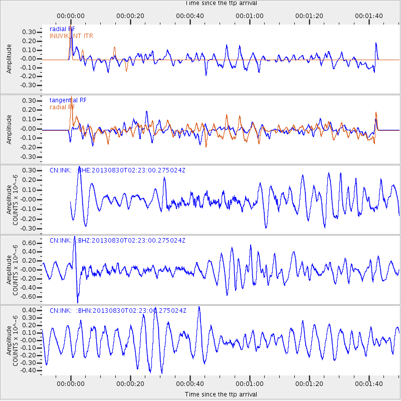
INK INUVIK, NT - Earthquake Result Viewer
*The percent match for this event was below the threshold and hence no stack was calculated.
| Earthquake location: |
New Britain Region, P.N.G. |
| Earthquake latitude/longitude: |
-4.4/151.6 |
| Earthquake time(UTC): |
2013/08/30 (242) 02:11:02 GMT |
| Earthquake Depth: |
203 km |
| Earthquake Magnitude: |
5.8 MWW, 5.8 MWB, 5.8 MWC, 5.8 MWW, 5.9 MWC |
| Earthquake Catalog/Contributor: |
NEIC PDE/NEIC COMCAT |
|
| Network: |
CN Canadian National Seismograph Network |
| Station: |
INK INUVIK, NT |
| Lat/Lon: |
68.31 N/133.53 W |
| Elevation: |
44 m |
|
| Distance: |
88.5 deg |
| Az: |
21.039 deg |
| Baz: |
254.314 deg |
| Ray Param: |
$rayparam |
*The percent match for this event was below the threshold and hence was not used in the summary stack. |
|
| Radial Match: |
63.572598 % |
| Radial Bump: |
400 |
| Transverse Match: |
23.832438 % |
| Transverse Bump: |
341 |
| SOD ConfigId: |
626651 |
| Insert Time: |
2014-04-18 04:41:04.821 +0000 |
| GWidth: |
2.5 |
| Max Bumps: |
400 |
| Tol: |
0.001 |
|
Signal To Noise
| Channel | StoN | STA | LTA |
| CN:INK: :BHZ:20130830T02:23:00.275024Z | 3.353617 | 3.487406E-7 | 1.0398939E-7 |
| CN:INK: :BHN:20130830T02:23:00.275024Z | 1.2005817 | 1.6132176E-7 | 1.3436969E-7 |
| CN:INK: :BHE:20130830T02:23:00.275024Z | 0.8563974 | 9.576165E-8 | 1.11819176E-7 |
| Arrivals |
| Ps | |
| PpPs | |
| PsPs/PpSs | |


