You are here: Home > Network List > IU - Global Seismograph Network (GSN - IRIS/USGS) Stations List
> Station JOHN Johnston Island, USA > Earthquake Result Viewer
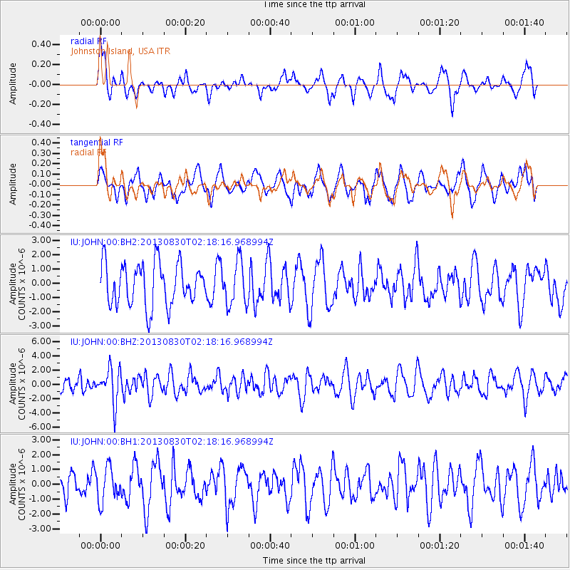
JOHN Johnston Island, USA - Earthquake Result Viewer
*The percent match for this event was below the threshold and hence no stack was calculated.
| Earthquake location: |
New Britain Region, P.N.G. |
| Earthquake latitude/longitude: |
-4.4/151.6 |
| Earthquake time(UTC): |
2013/08/30 (242) 02:11:02 GMT |
| Earthquake Depth: |
203 km |
| Earthquake Magnitude: |
5.8 MWW, 5.8 MWB, 5.8 MWC, 5.8 MWW, 5.9 MWC |
| Earthquake Catalog/Contributor: |
NEIC PDE/NEIC COMCAT |
|
| Network: |
IU Global Seismograph Network (GSN - IRIS/USGS) |
| Station: |
JOHN Johnston Island, USA |
| Lat/Lon: |
16.73 N/169.53 W |
| Elevation: |
2.0 m |
|
| Distance: |
43.8 deg |
| Az: |
60.316 deg |
| Baz: |
244.688 deg |
| Ray Param: |
$rayparam |
*The percent match for this event was below the threshold and hence was not used in the summary stack. |
|
| Radial Match: |
49.68107 % |
| Radial Bump: |
400 |
| Transverse Match: |
49.112923 % |
| Transverse Bump: |
400 |
| SOD ConfigId: |
626651 |
| Insert Time: |
2014-04-18 04:43:24.897 +0000 |
| GWidth: |
2.5 |
| Max Bumps: |
400 |
| Tol: |
0.001 |
|
Signal To Noise
| Channel | StoN | STA | LTA |
| IU:JOHN:00:BHZ:20130830T02:18:16.968994Z | 2.9620032 | 2.4754063E-6 | 8.3572036E-7 |
| IU:JOHN:00:BH1:20130830T02:18:16.968994Z | 1.1509051 | 1.1569308E-6 | 1.0052356E-6 |
| IU:JOHN:00:BH2:20130830T02:18:16.968994Z | 1.0550039 | 1.5513433E-6 | 1.4704622E-6 |
| Arrivals |
| Ps | |
| PpPs | |
| PsPs/PpSs | |


