You are here: Home > Network List > TA - USArray Transportable Network (new EarthScope stations) Stations List
> Station O03E Paynes Creek, CA, USA > Earthquake Result Viewer
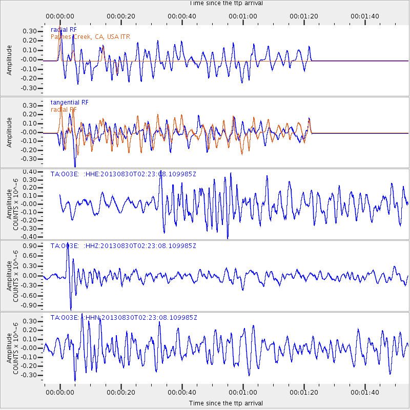
O03E Paynes Creek, CA, USA - Earthquake Result Viewer
*The percent match for this event was below the threshold and hence no stack was calculated.
| Earthquake location: |
New Britain Region, P.N.G. |
| Earthquake latitude/longitude: |
-4.4/151.6 |
| Earthquake time(UTC): |
2013/08/30 (242) 02:11:02 GMT |
| Earthquake Depth: |
203 km |
| Earthquake Magnitude: |
5.8 MWW, 5.8 MWB, 5.8 MWC, 5.8 MWW, 5.9 MWC |
| Earthquake Catalog/Contributor: |
NEIC PDE/NEIC COMCAT |
|
| Network: |
TA USArray Transportable Network (new EarthScope stations) |
| Station: |
O03E Paynes Creek, CA, USA |
| Lat/Lon: |
40.29 N/121.80 W |
| Elevation: |
967 m |
|
| Distance: |
90.2 deg |
| Az: |
49.775 deg |
| Baz: |
264.429 deg |
| Ray Param: |
$rayparam |
*The percent match for this event was below the threshold and hence was not used in the summary stack. |
|
| Radial Match: |
66.358665 % |
| Radial Bump: |
291 |
| Transverse Match: |
48.67394 % |
| Transverse Bump: |
278 |
| SOD ConfigId: |
626651 |
| Insert Time: |
2014-04-18 04:47:15.866 +0000 |
| GWidth: |
2.5 |
| Max Bumps: |
400 |
| Tol: |
0.001 |
|
Signal To Noise
| Channel | StoN | STA | LTA |
| TA:O03E: :HHZ:20130830T02:23:08.109985Z | 11.160168 | 4.390637E-7 | 3.9342037E-8 |
| TA:O03E: :HHN:20130830T02:23:08.109985Z | 1.1284896 | 1.06206826E-7 | 9.411414E-8 |
| TA:O03E: :HHE:20130830T02:23:08.109985Z | 2.5848992 | 1.8120731E-7 | 7.0102274E-8 |
| Arrivals |
| Ps | |
| PpPs | |
| PsPs/PpSs | |


